Sandy_Point_Farmhouse_Dec_09.JPG

Size of this preview:
800 × 600 pixels
.
Other resolutions:
320 × 240 pixels
|
640 × 480 pixels
|
1,024 × 768 pixels
|
1,280 × 960 pixels
|
2,592 × 1,944 pixels
.
|
|
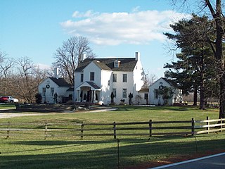
This is an image of a place or building that is listed on the
National Register of Historic Places
in the
United States of America
. Its reference number is
72000566
.
|
Summary
| Description |
English:
Sandy Point Farmhouse, December 2009
|
| Date | 28 December 2009 (original upload date) |
| Source |
Own work
(Original caption: "
")
Transferred from en.wikipedia to Commons by User:Quadell using CommonsHelper . |
| Author | Pubdog at en.wikipedia |
| Object location |
|
View this and other nearby images on: OpenStreetMap |
|
|---|
Licensing
|
|
This work has been released into the
public domain
by its author,
Pubdog
at
English Wikipedia
. This applies worldwide.
In some countries this may not be legally possible; if so: Pubdog grants anyone the right to use this work for any purpose , without any conditions, unless such conditions are required by law. |
Original upload log
The original description page was
here
. All following user names refer to en.wikipedia.
- 2009-12-28 23:08 Pubdog 2592×1944× (768812 bytes) {{Information |Description = Sandy Point Farmhouse, December 2009 |Source = I (~~~) created this work entirely by myself. |Date = ~~~~~ |Author = ~~~ |other_versions = }}