SalernoDDayPlans1943.jpg

Size of this preview:
800 × 553 pixels
.
Other resolutions:
320 × 221 pixels
|
640 × 442 pixels
|
1,024 × 707 pixels
|
1,200 × 829 pixels
.
Summary
| Description |
English:
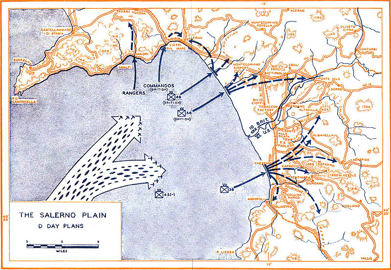
Plans for Allied Landings at Salerno 9 September 1943
|
| Date | |
| Source | http://www.history.army.mil/books/wwii/salerno/sal-maps.htm#m2 |
| Author | Historical Division, US War Department |
| Location | +40° 28' 56.90", +14° 48' 48.46" |
Extracted from SALERNO American Operations From the Beaches to the Volturno 9 September - 6 October 1943. Center of Military History Publication 100-7
Licensing
|
|
This file is a work of a
U.S. Army
soldier or employee, taken or made as part of that person's official duties. As a
work
of the
U.S. federal government
, it is in the
public domain
in the United States.
|

|