Sagami_Bay_Location_map_20161105.svg

Size of this PNG preview of this SVG file:
340 × 255 pixels
.
Other resolutions:
320 × 240 pixels
|
640 × 480 pixels
|
1,024 × 768 pixels
|
1,280 × 960 pixels
|
2,560 × 1,920 pixels
.
| Description |
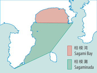
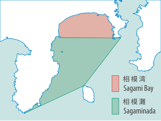
English:
Location map of
Sagami Bay
, Japan.
日本語:
相模湾
の範囲図。定義の出典は以下の通り。
|
| Date | |
| Source |
Own work using |
| Author | NordNordWest and OpenStreetMap contributors and Batholith |

|
This map has been made or improved in the German
Kartenwerkstatt
(Map Lab)
. You can
propose maps
to improve as well.
|
This file is licensed under the
Creative Commons
Attribution-Share Alike 2.0 Generic
license.
-
You are free:
- to share – to copy, distribute and transmit the work
- to remix – to adapt the work
-
Under the following conditions:
- attribution – You must give appropriate credit, provide a link to the license, and indicate if changes were made. You may do so in any reasonable manner, but not in any way that suggests the licensor endorses you or your use.
- share alike – If you remix, transform, or build upon the material, you must distribute your contributions under the same or compatible license as the original.