Russian-occupied_territories_in_map.jpg
Size of this preview:
800 × 403 pixels
.
Other resolutions:
320 × 161 pixels
|
640 × 323 pixels
|
1,024 × 516 pixels
|
1,280 × 645 pixels
|
3,840 × 1,935 pixels
.

|
File:Russian occupied territories in map.svg
is a vector version of this file. It should be used in place of this JPG file when not inferior.
File:Russian-occupied territories in map.jpg →
File:Russian occupied territories in map.svg
For more information, see
Help:SVG
.
|

|
Summary
| Description |
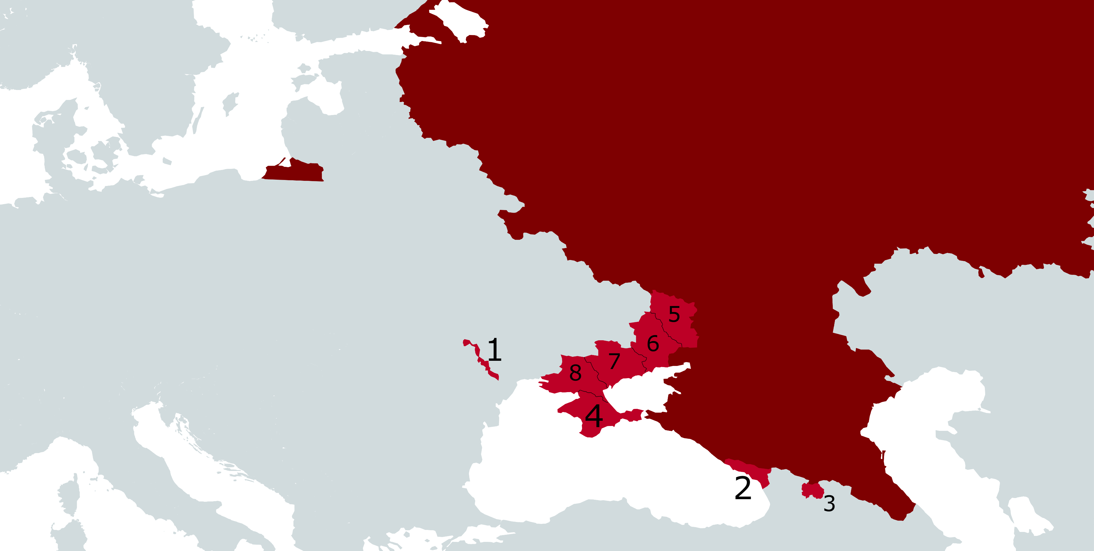
English:
Map showing Russia in dark red with
Russian-occupied territories
in Europe in light red, as follows:
|
| Date | |
| Source |
Own work . Compare:
|
| Author | Gabriel Ziegler |
Licensing
I, the copyright holder of this work, hereby publish it under the following license:
This file is licensed under the
Creative Commons
Attribution-Share Alike 4.0 International
license.
-
You are free:
- to share – to copy, distribute and transmit the work
- to remix – to adapt the work
-
Under the following conditions:
- attribution – You must give appropriate credit, provide a link to the license, and indicate if changes were made. You may do so in any reasonable manner, but not in any way that suggests the licensor endorses you or your use.
- share alike – If you remix, transform, or build upon the material, you must distribute your contributions under the same or compatible license as the original.