Rus-10c-ethn.png
Size of this preview:
492 × 600 pixels
.
Other resolutions:
197 × 240 pixels
|
394 × 480 pixels
|
630 × 768 pixels
|
840 × 1,024 pixels
|
2,241 × 2,731 pixels
.
Summary
| Description |
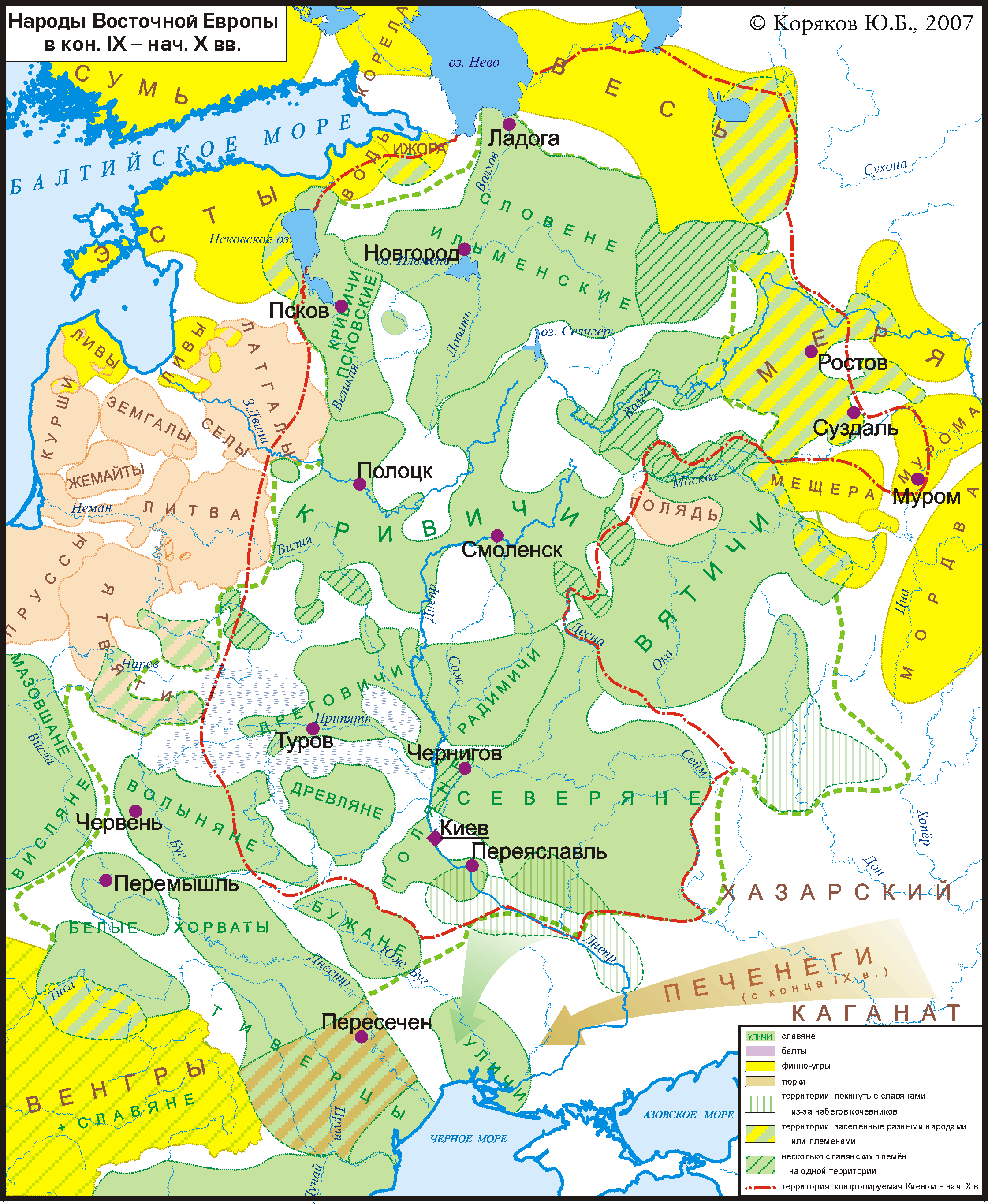
Русский:
Карта расселения славян и их соседей в кон. 9 -- нач. 10 вв. в Восточной Европе. Показана граница Киевской Руси на нач. 10 в. Основана на археологических картах и описаниях, в частности взятых из работ В.В.Седова (в основном данные по славянам) и тома "Финно-угры и балты в эпоху средневековья" (М.: 1987) из серии Археология СССР (в основном данные по балтам и финно-уграм).
English:
Ethnic groups of East Europe in late 9 -- early 10 cc.
Deutsch:
Ethnische Gruppen in Osteuropa im späten 9. bis frühen 10. Jahrhundert
|
| Date | |
| Source | Own work |
| Author | Koryakov Yuri |

|
This
map
image could be re-created
using
vector graphics
as an
SVG
file
. This has several advantages; see
Commons:Media for cleanup
for more information. If an SVG form of this image is available, please upload it and afterwards replace this template with
{{

vector version available

|

new image name

}}
.
It is recommended to name the SVG file “Rus-10c-ethn.svg”—then the template Vector version available (or Vva ) does not need the new image name parameter. |

Licensing
I, the copyright holder of this work, hereby publish it under the following license:
This file is licensed under the
Creative Commons
Attribution-Share Alike 3.0 Unported
license.
-
You are free:
- to share – to copy, distribute and transmit the work
- to remix – to adapt the work
-
Under the following conditions:
- attribution – You must give appropriate credit, provide a link to the license, and indicate if changes were made. You may do so in any reasonable manner, but not in any way that suggests the licensor endorses you or your use.
- share alike – If you remix, transform, or build upon the material, you must distribute your contributions under the same or compatible license as the original.