Rosario_gas_explosion_-_location_map.png
No higher resolution available.
Summary
| Description |
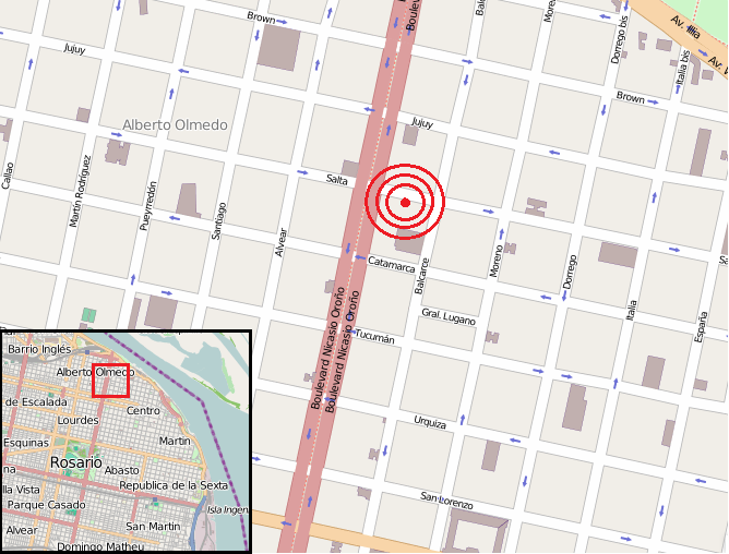
Español:
Ubicación del edificio siniestrado en la explosión de gas del de agosto en Rosario
|
|||
| Date | ||||
| Source | Open Street Map | |||
| Author | http://www.openstreetmap.org/copyright | |||
|
Permission
( Reusing this file ) |
OpenStreetMap data is available under the Open Database License ( details ). Map tiles are licensed under the Creative Commons Attribution-ShareAlike 2.0 license (CC-BY-SA 2.0).
This file is licensed under the
Creative Commons
Attribution-Share Alike 2.0 Generic
license.
|