Roman_Empires_476AD.svg

Size of this PNG preview of this SVG file:
800 × 389 pixels
.
Other resolutions:
320 × 156 pixels
|
640 × 311 pixels
|
1,024 × 498 pixels
|
1,280 × 623 pixels
|
2,560 × 1,246 pixels
|
1,753 × 853 pixels
.
Jkbbkj
Summary
| Description |
English:
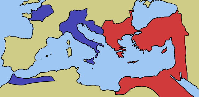
A map of the territories controlled by Eastern and Western Roman Empires as of 476AD.
|
| Date | |
| Source | Own work |
| Author | Cthuljew |
| Other versions | http://en.wikipedia.org/wiki/File:628px-Western_and_Eastern_Roman_Empires_476AD(4).PNG |
.PNG)
Licensing
|
|
I, the copyright holder of this work, release this work into the
public domain
. This applies worldwide.
In some countries this may not be legally possible; if so: I grant anyone the right to use this work for any purpose , without any conditions, unless such conditions are required by law. |