Road.sign.arp.750pix.jpg

Size of this preview:
721 × 600 pixels
.
Other resolutions:
289 × 240 pixels
|
577 × 480 pixels
|
750 × 624 pixels
.
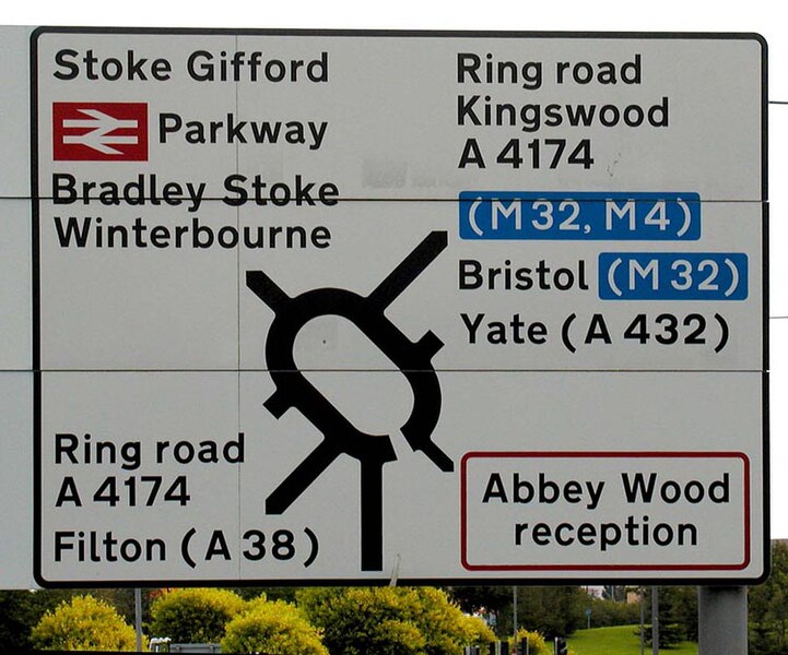
| Description | A road sign near Bristol, England. The direction sign is patched according to the Guildford Rules. It gives directions to (Bristol) Parkway railway station (red British Rail symbol), motorways (blue-background patches), and towns reached via non-primary A-roads. Red-edged patches and red-bordered signs are used for military establishments (the Ministry of Defence at Abbey Wood in this example). Destinations which are reached indirectly have the corresponding road number in brackets; for instance, this sign says that Filton is reached by following the A4174 ring road to the A38, and then turning onto the A38 for Filton. | ||
| Date | |||
| Source | Taken by Adrian Pingstone in October 2004 and released to the public domain. | ||
| Author | User Arpingstone on en.wikipedia | ||
|
Permission
( Reusing this file ) |
|
||
| Other versions |
Originally from en.wikipedia ; description page is (was) here * 19:06, 8 October 2004 [[:en:User:Arpingstone|Arpingstone]] 750×624 (110,953 bytes) <span class="comment">(Road Sign)</span> |