RichlandWaEMSL.jpg

Size of this preview:
800 × 511 pixels
.
Other resolutions:
320 × 204 pixels
|
640 × 409 pixels
|
1,024 × 654 pixels
|
1,280 × 817 pixels
|
1,984 × 1,267 pixels
.
Summary
| Description |
English:
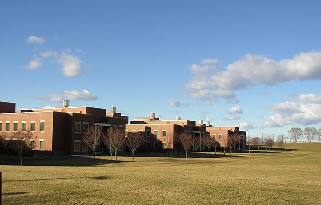
Photos of Richland, Washington taken on a 50°F Sunday, January 15, 2006 for the specific purpose of being uploaded to the Wikipedia. This photo shows the William R. Wiley Environmental Molecular Sciences Laboratory (EMSL), a U.S. Department of Energy national scientific user facility at the Pacific Northwest National Laboratory. EMSL provides integrated experimental and computational resources for discovery and technological innovation in the environmental molecular sciences.
All rights are released; they are henceforth & forever in the public domain.
|
| Date | |
| Source | Umptanum (presumed) |
| Author | Umptanum |
| Object location |
|
View this and other nearby images on: OpenStreetMap |
|
|---|
Licensing
|
|
This work has been released into the
public domain
by its author,
Umptanum
at
English Wikipedia
. This applies worldwide.
In some countries this may not be legally possible; if so: Umptanum grants anyone the right to use this work for any purpose , without any conditions, unless such conditions are required by law. |
Original upload log
Transferred from en.wikipedia to Commons by Allen4names using CommonsHelper .
The original description page was
here
. All following user names refer to en.wikipedia.
- 2006-01-16 01:36 Umptanum 1984×1267× (453535 bytes) Photos of Richland, Washington taken on a lovely 50°F Sunday, January 15, 2006 for the specific purpose of being uploaded to the Wikipedia. All rights are released; they are henceforth & forever in the public domain until the sun does not rise in the ea