Relief_Map_of_Shida_Kartli.svg

Size of this PNG preview of this SVG file:
640 × 600 pixels
.
Other resolutions:
256 × 240 pixels
|
819 × 768 pixels
|
1,092 × 1,024 pixels
|
2,185 × 2,048 pixels
|
783 × 734 pixels
.
Summary
| Description |
English:
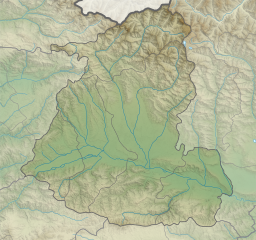
Relief map of
Shida Kartli
Mercator projection. Geographic limits of the map:
|
||
| Date | |||
| Source | Own work by the original uploader | ||
| Author | Giorgi Balakhadze at English Wikipedia |


Licensing
Giorgi Balakhadze
at
English Wikipedia
, the copyright holder of this work, hereby publishes it under the following license:
This file is licensed under the
Creative Commons
Attribution 4.0 International
license.
Attribution:
Giorgi Balakhadze
at
English Wikipedia
-
You are free:
- to share – to copy, distribute and transmit the work
- to remix – to adapt the work
-
Under the following conditions:
- attribution – You must give appropriate credit, provide a link to the license, and indicate if changes were made. You may do so in any reasonable manner, but not in any way that suggests the licensor endorses you or your use.
Original upload log
The original description page was
here
. All following user names refer to en.wikipedia.
| Date/Time | Dimensions | User | Comment |
|---|---|---|---|
| 2016-06-17 13:29 | 783×734× (8608739 bytes) | Giorgi Balakhadze | fix |
| 2016-06-17 12:40 | 783×734× (8613485 bytes) | Giorgi Balakhadze | {{Copy to Commons|human=Giorgi Balakhadze}} == Summary == {{Information |Description={{en|Relief map of [[:en:Georgia (country)|Georgia]]}} </br>Mercator projection. Geographic limits of the map: * N: 42.65° N * S: 41.68° N * W: 43.31.8° E * E: 44.6... |