RegionsHungary.png
No higher resolution available.

|
This
locator map
image could be re-created
using
vector graphics
as an
SVG
file
. This has several advantages; see
Commons:Media for cleanup
for more information. If an SVG form of this image is available, please upload it and afterwards replace this template with
{{

vector version available

|

new image name

}}
.
It is recommended to name the SVG file “RegionsHungary.svg”—then the template Vector version available (or Vva ) does not need the new image name parameter. |
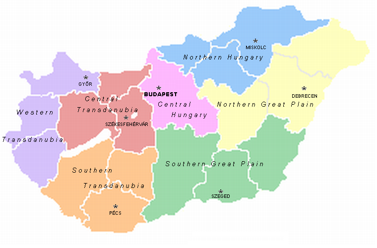
A map of the seven statistical regions of Hungary with their regional centres. It was made by User:Alensha by modifying the maps of the counties that also can be found here. If it means that the copyright is mine then I release it to public domain but if it belongs to the guy who made the pic Zalamegye.png from which it was modified, then it is GNU FDL.

|
Permission is granted to copy, distribute and/or modify this document under the terms of the GNU Free Documentation License , Version 1.2 or any later version published by the Free Software Foundation ; with no Invariant Sections, no Front-Cover Texts, and no Back-Cover Texts. A copy of the license is included in the section entitled GNU Free Documentation License . |
|
|
This file is licensed under the Creative Commons Attribution-Share Alike 3.0 Unported license. | |
|
||
| This licensing tag was added to this file as part of the GFDL licensing update . |