RegioniIrredenteItalia.jpg
Size of this preview:
460 × 600 pixels
.
Other resolutions:
184 × 240 pixels
|
632 × 824 pixels
.
Summary
| Description |
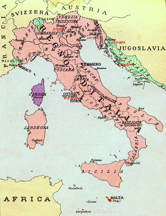
Map of Kingdom of Italy (1919) showing the areas claimed by Irredentism: in red Malta, in purple Corsica, in yellow with green points Dalmatia, Ticino and Nizzardo. I have used as a basic map an old map from an Italian geography and history school book of 1935 "Scuole Medie Inferiori", and I have written and painted on it.
Cropped caption: L’Italia dopo la Guerra 1915-1918 |
| Date | |
| Source | Own work |
| Author | Brunodambrosio |
| Other versions | File:Nesvobodni rajoni Italija.png |
Licensing
|
|
I, the copyright holder of this work, release this work into the
public domain
. This applies worldwide.
In some countries this may not be legally possible; if so: I grant anyone the right to use this work for any purpose , without any conditions, unless such conditions are required by law. |