Ravensberger-Mulde.png
Size of this preview:
763 × 599 pixels
.
Other resolutions:
306 × 240 pixels
|
611 × 480 pixels
|
978 × 768 pixels
|
1,280 × 1,005 pixels
|
2,000 × 1,571 pixels
.
| Description |
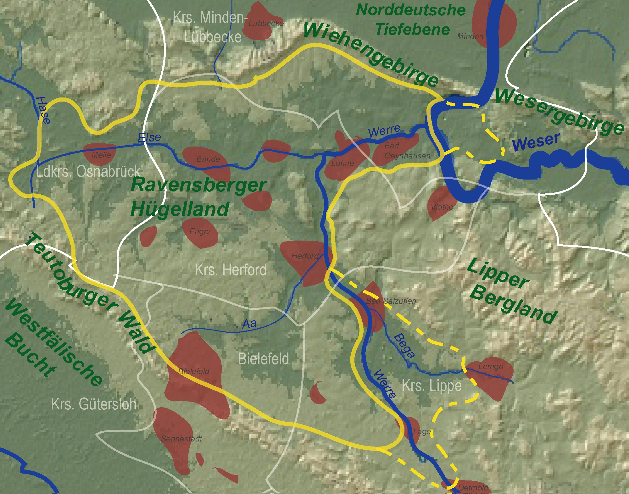
Deutsch:
de:Ravensberger Mulde
: Core and extended area
|
| Date | 1 June 2008 (original upload date) |
| Source |
Transferred from
de.wikipedia
to Commons.
based upon de:Bild:Ravensberger-Land.png by TUBS based upon de:Bild:Karte Niedersaechsisches Bergland.jpg by de:Benutzer:Langläufer |
| Author | TUBS |
| Object location |
|
View this and other nearby images on: OpenStreetMap |
|
|---|
Licensing
|
|
I, the copyright holder of this work, release this work into the
public domain
. This applies worldwide.
In some countries this may not be legally possible; if so: I grant anyone the right to use this work for any purpose , without any conditions, unless such conditions are required by law. |
Original upload log
The original description page was
here
. All following user names refer to de.wikipedia.
- 2008-06-01 13:30 TUBS 2000×1571× (490427 bytes) corrected thoroughly
- 2007-10-20 16:12 TUBS 423×366× (296296 bytes) corrected borders around [[Vlotho]]
- 2007-10-17 16:01 TUBS 660×501× (507020 bytes) Borders corrected
- 2007-10-17 14:58 TUBS 732×528× (585298 bytes) {{Information |Beschreibung = [[Ravensberger Mulde]]: Core and extended area |Quelle = based upon [[:Bild:Ravensberger-Land.png]] |Urheber = |Datum = |Genehmigung = |Andere Versionen = |Anmerkungen = }}