Rauer_Islands.jpg
No higher resolution available.
Summary
| Description |
English:
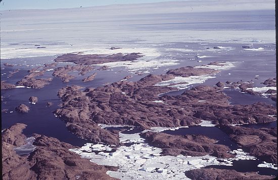
A group of rocky coastal islands which lie between Sorsdal Glacier Tongue and Ranvik Bay, in the SE part of Prydz Bay, in Antarctica
|
| Date | |
| Source | https://data.aad.gov.au/aadc/gaz/display_name.cfm?gaz_id=130574 |
| Author | Williams, Richard (Dick) |
| Camera location |
|
View this and other nearby images on: OpenStreetMap |
|
|---|
©AAD, Copyright Commonwealth of Australia 1974 https://data.aad.gov.au/aadc/about/condition_of_use.cfm
Licensing
This file is licensed under the
Creative Commons
Attribution 4.0 International
license.
-
You are free:
- to share – to copy, distribute and transmit the work
- to remix – to adapt the work
-
Under the following conditions:
- attribution – You must give appropriate credit, provide a link to the license, and indicate if changes were made. You may do so in any reasonable manner, but not in any way that suggests the licensor endorses you or your use.