RamseyUnitsBrazTX.png

Size of this preview:
800 × 481 pixels
.
Other resolutions:
320 × 192 pixels
|
640 × 385 pixels
|
908 × 546 pixels
.
Summary
| Description |
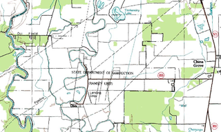
English:
USGS
topographic map
of the Ramsey Units in Texas:
Ramsey
(Ramsey I),
Stringfellow
(Ramsey II), and
Terrell
(Ramsey III).
Español:
Mapa topográfico de las Unidades Ramsey (Unidades Ramsey (Ramsey I), Stringfellow (Ramsey II), y Terrell (Ramsey III))
|
| Date | |
| Source |
USGS The National Map , via MSR Maps (formerly TerraServer-USA) |
| Author |
English:
United States Geological Survey
(USGS)
Español:
Servicio Geológico de los Estados Unidos
|
|
Permission
( Reusing this file ) |
Public domain |
Licensing
|
|
This image is in the
public domain
in the United States because it only contains materials that originally came from the
United States Geological Survey
, an agency of the
United States Department of the Interior
. For more information, see
the official USGS copyright policy
.
|
|