Rama's_bridge.jpg

Size of this preview:
800 × 455 pixels
.
Other resolutions:
320 × 182 pixels
|
640 × 364 pixels
|
1,024 × 582 pixels
|
1,280 × 727 pixels
|
2,818 × 1,601 pixels
.
Summary
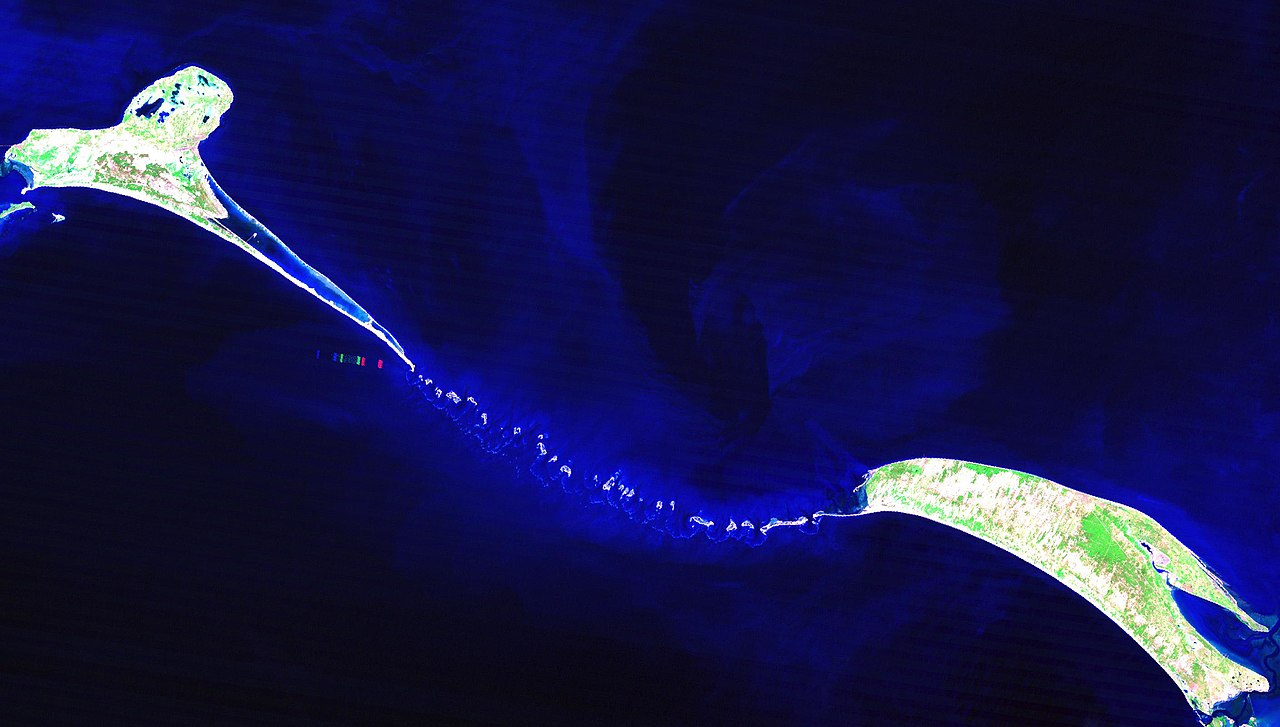
| Description | Rama's Bridge. A subset of Landsat 5 TM true color composite of Rama's bridge or Ram Setu (referred by British cartographers as Adam's Bridge). Path 142 Row 54; Bands 742 (RGB); Resolution 30 meter. Original image acquired on 6 February, 1988 at 4:42:00 GMT. |
| Date | |
| Source | The source of the original data set: Global Land Cover Facility, www.landcover.org. |
| Author | THK |
|
Permission
( Reusing this file ) |
Rights of the original data set: Use is free to all; effectively held by USGS & NASA; but ultimately held by US public. Image processing, true color compositing and flat image (jpg) creation by THK (2007) and released under Creative Commons Attribution ShareAlike license version 3.0. |
Licensing
This file is licensed under the
Creative Commons
Attribution-Share Alike 3.0 Unported
license.
-
You are free:
- to share – to copy, distribute and transmit the work
- to remix – to adapt the work
-
Under the following conditions:
- attribution – You must give appropriate credit, provide a link to the license, and indicate if changes were made. You may do so in any reasonable manner, but not in any way that suggests the licensor endorses you or your use.
- share alike – If you remix, transform, or build upon the material, you must distribute your contributions under the same or compatible license as the original.