Putnam_Historic_District,_Zanesville.jpg

Size of this preview:
800 × 600 pixels
.
Other resolutions:
320 × 240 pixels
|
640 × 480 pixels
|
1,024 × 768 pixels
|
1,280 × 960 pixels
|
2,560 × 1,920 pixels
|
2,816 × 2,112 pixels
.
|
|
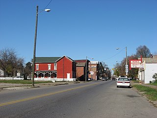
This is an image of a place or building that is listed on the
National Register of Historic Places
in the
United States of America
. Its reference number is
75001511
.
|
| Camera location |
|
View this and other nearby images on: OpenStreetMap |
|
|---|
| Description |
English:
Northward along Putnam Avenue (
U.S. Route 22
) between its intersections with Van Buren and Madison Streets in southern
Zanesville
,
Ohio
,
United States
. The neighborhood pictured is part of the
Putnam Historic District
, a
historic district
that is listed on the
National Register of Historic Places
.
|
||
| Date | Taken on 12 November 2009 | ||
| Source | Own work | ||
| Author | Nyttend | ||
|
Permission
( Reusing this file ) |
|