Ptolemaic_and_Roman_Egypt.jpg

Size of this preview:
402 × 599 pixels
.
Other resolutions:
161 × 240 pixels
|
322 × 480 pixels
|
515 × 768 pixels
|
687 × 1,024 pixels
|
1,374 × 2,048 pixels
|
2,959 × 4,409 pixels
.
Summary
| Description |
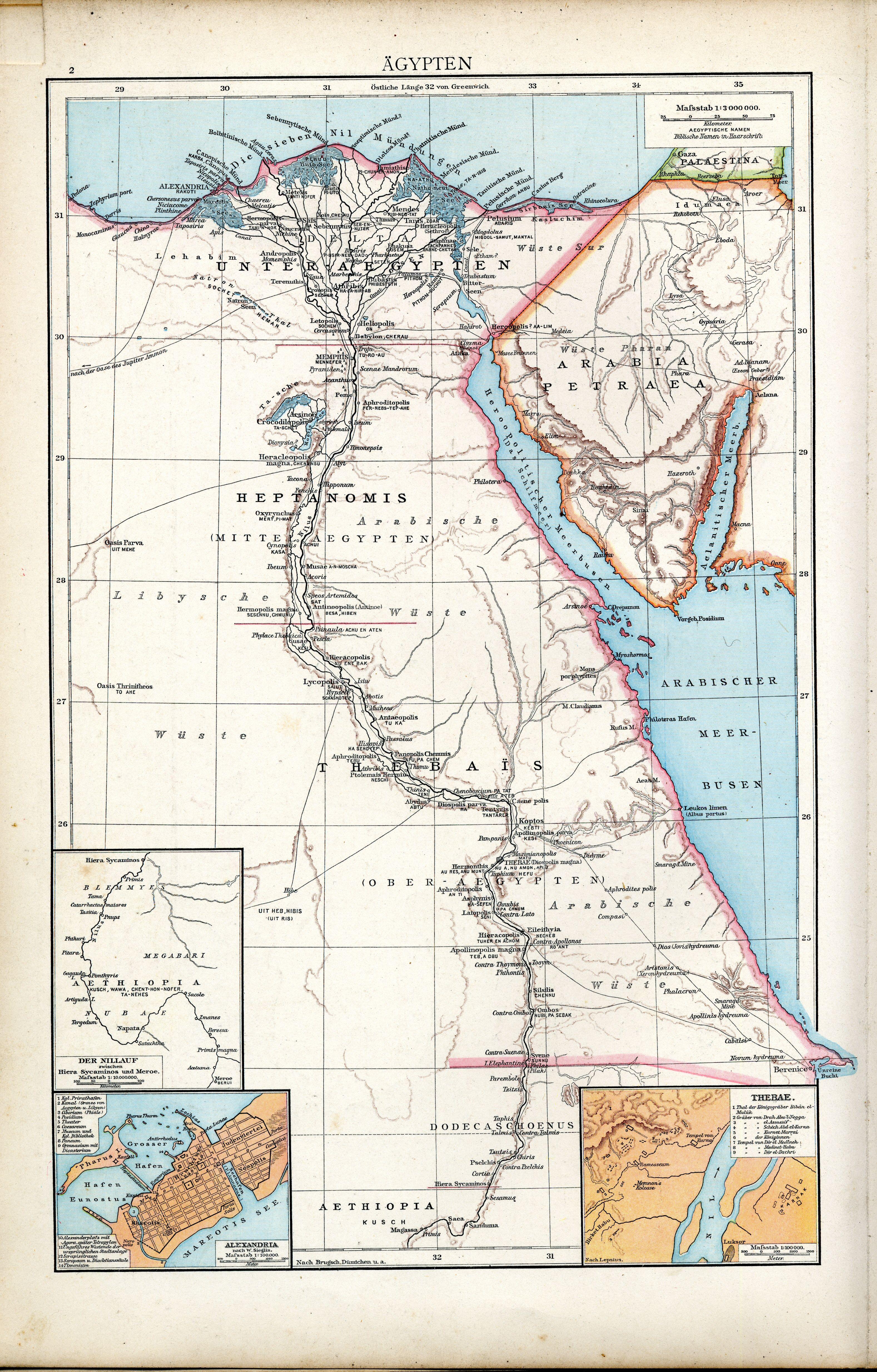
Deutsch:
Ägypten.
(Karte aus dem Historischen Handatlas von Gustav Droysen, 1886)
English:
Egypt.
(Map of the Historical Atlas of Gustav Droysen, 1886)
Français :
Carte de l'Egypte antique ptolémaïque et romaine. Carte issue de l'
Allgemeiner Historischer Handatlas
de
Gustav Droysen
dirigé par Richard Andree, 1886.
|
||||||
| Date | |||||||
| Source | Ägypten. In: Professor G. Droysens Allgemeiner Historischer Handatlas in sechsundneunzig Karten, mit erläuterndem Text. Velhagen & Klasing, Bielefeld/Leipzig 1886. | ||||||
| Author | Gustav Droysen (1838–1908) | ||||||
|
Permission
( Reusing this file ) |
|
||||||