Poughkeepsie_Bridge_Route_map.jpg
No higher resolution available.
Summary
| Description |
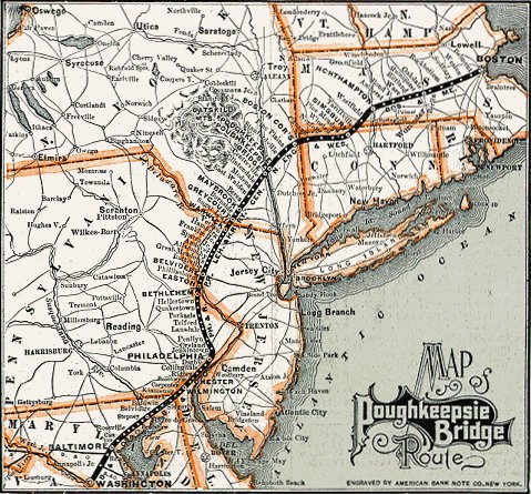
English:
An map of the
Poughkeepsie Bridge Route
, circa 1892
.
|
| Date | between 1890 and 1892 |
| Source | |
| Author | Unknown author |

Licensing
|
|
This work was published before January 1, 1929 and it is anonymous or pseudonymous due to unknown authorship. It is in the
public domain
in the United States as well as countries and areas where the
copyright terms of anonymous or pseudonymous works
are
95 years or fewer since publication
.
|
Original upload log
This image is a derivative work of the following images:
-
File:Poughkeepsie_Bridge_Route.gif
licensed with PD-US, PD-anon-1923
- 2009-10-13T00:22:29Z File Upload Bot (Magnus Manske) 791x480 (112552 Bytes) {{BotMoveToCommons|en.wikipedia|year={{subst:CURRENTYEAR}}|month={{subst:CURRENTMONTHNAME}}|day={{subst:CURRENTDAY}}}} {{Information |Description={{en|An advertisement for the [[:en:Poughkeepsie Bridge Route|]]. It is from b
Uploaded with derivativeFX