Portugalliae_et_Algarbiae_cum_finitimis_Hispaniae_regnis_1710_Johann_Baptist_Homann.jpg
Size of this preview:
692 × 600 pixels
.
Other resolutions:
277 × 240 pixels
|
554 × 480 pixels
|
886 × 768 pixels
|
1,182 × 1,024 pixels
|
1,313 × 1,138 pixels
.
Summary
| Description |
Español:
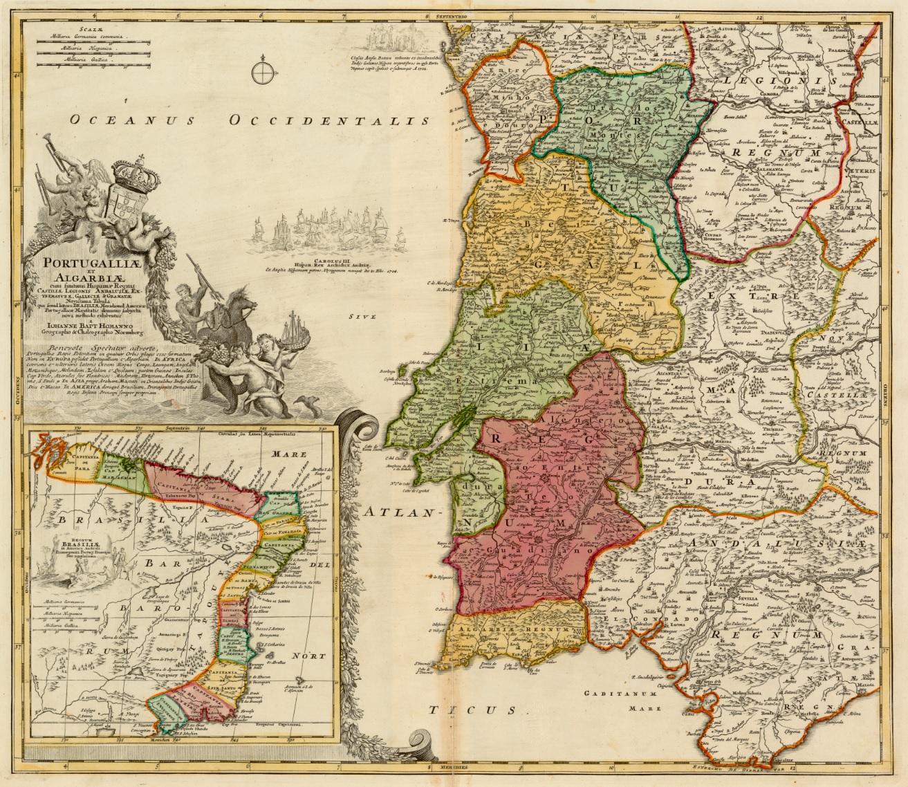
Mapa de 1710 que muestra las divisiones administrativas del Reino de Portugal y del Algarve, así como del Reino de Brasilo dependiente del rey portugués
|
|||||||||||||||||||||||
| Date | ||||||||||||||||||||||||
| Source | Institut Cartogràfic de Catalunya | |||||||||||||||||||||||
| Author |
|
|||||||||||||||||||||||
.jpg)
Licensing
|
|
This work is in the public domain in its country of origin and other countries and areas where the copyright term is the author's life plus 70 years or fewer . This work is in the public domain in the United States because it was published (or registered with the U.S. Copyright Office ) before January 1, 1929. |
| This file has been identified as being free of known restrictions under copyright law, including all related and neighboring rights. | |