Portugal_topographic_map-pt.png
Size of this preview:
339 × 599 pixels
.
Other resolutions:
136 × 240 pixels
|
272 × 480 pixels
|
435 × 768 pixels
|
579 × 1,024 pixels
|
1,738 × 3,070 pixels
.
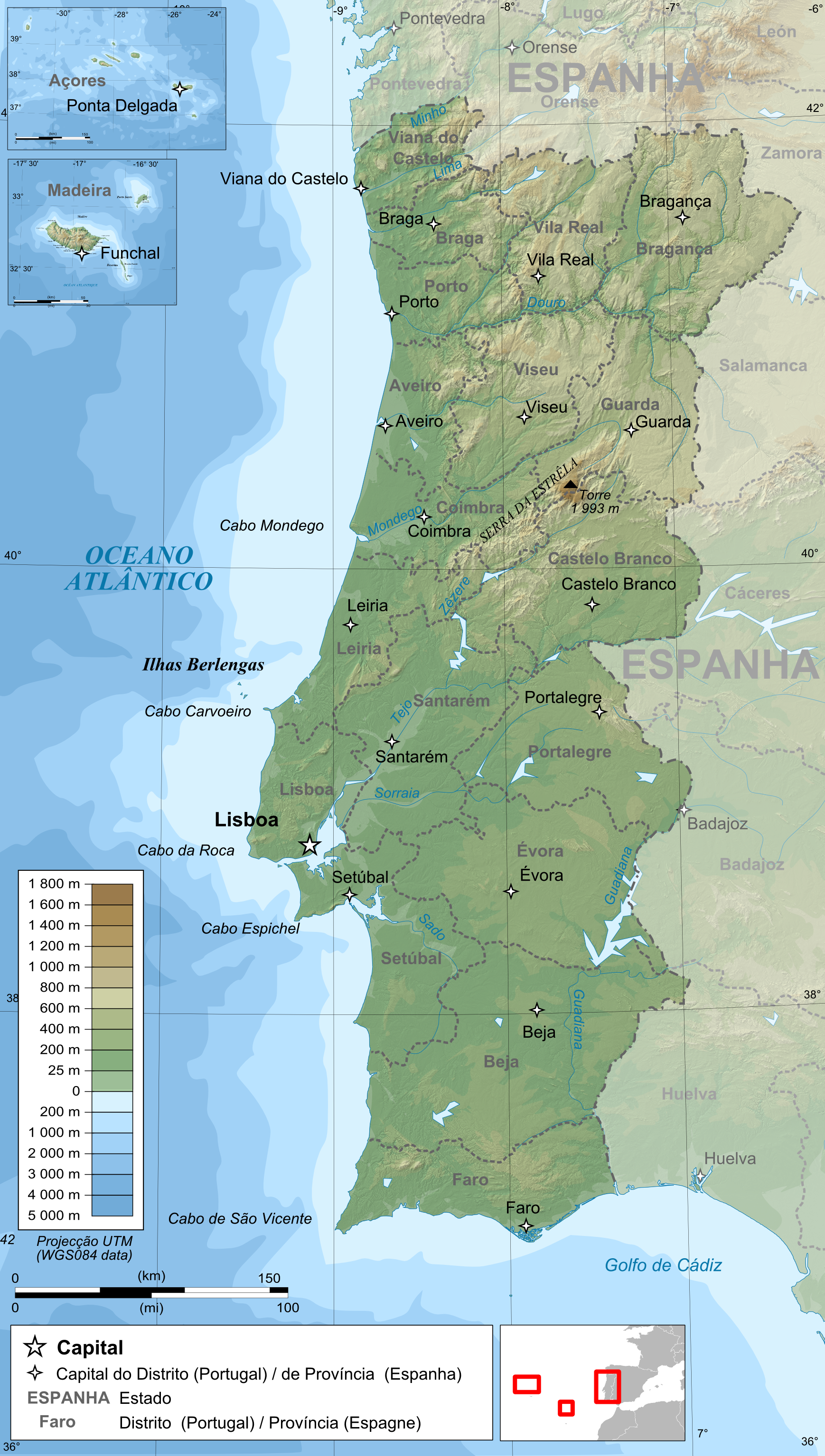
| Description |
Français :
Carte topographique et administrative en portugais du
Portugal
Português:
Carta topográfica e da administração do
Portugal
, em português
Deutsch:
Topographische Karte von
Portugal
, portugiesische Version
English:
Topographic and administrative map in Portuguese of
Portugal
Español:
Mapa topográfico y administrativo en portugés del
Portugal
Italiano:
Carta topografica e amministrativa de
Portogallo
日本語:
ポルトガル語で表示した
ポルトガル
地形·行政地図
|
||
| Date | |||
| Source |
English:
Own work ;
Français :
Création personnelle ;
|
||
| Author | Bourrichon - fr:Bourrichon | ||
|
Permission
( Reusing this file ) |
I, the copyright holder of this work, hereby publish it under the following licenses:
This file is licensed under the
Creative Commons
Attribution-Share Alike
3.0 Unported
,
2.5 Generic
,
2.0 Generic
and
1.0 Generic
license.
You may select the license of your choice.
|
||
| Other versions |
|


