Polar_low.jpg
No higher resolution available.
Summary
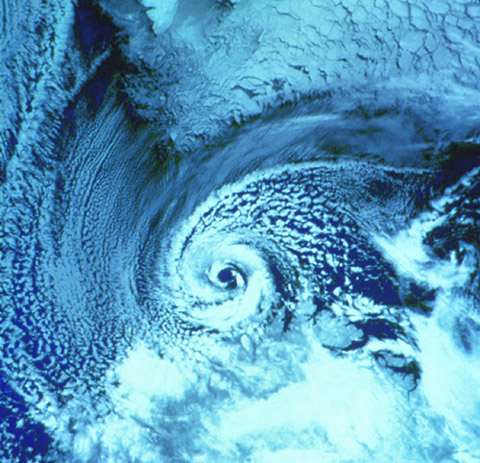
A NOAA-9 polar orbiter satellite image (visible band) of a polar low over the Barents Sea on 27 February 1987. The southern tip of Spitsbergen is visible at the top of the image. The polar low is centered just north of the Norwegian coast. [1]
Imported from the france Wikipedia
Licensing
|
|
This image is in the
public domain
because it contains materials that originally came from the U.S.
National Oceanic and Atmospheric Administration
, taken or made as part of an employee's official duties.
|
|