Podział_administracyjny_I_RP.png

Size of this preview:
683 × 600 pixels
.
Other resolutions:
273 × 240 pixels
|
547 × 480 pixels
|
875 × 768 pixels
|
1,167 × 1,024 pixels
|
2,333 × 2,048 pixels
|
3,535 × 3,103 pixels
.
| Description |
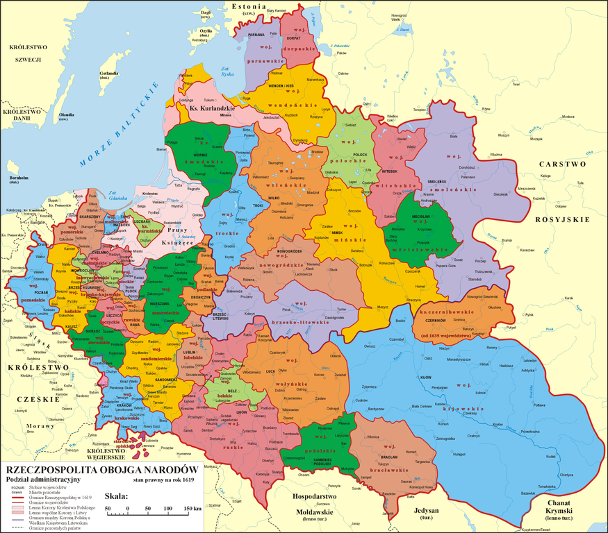
Polski:
Podział administracyjny Rzeczypospolitej Obojga Narodów w 1619 r.
English:
Administrative division of the Polish-Lithuanian Commonwealth, 1619
Deutsch:
Administrative Verwaltung in Form von Wojewodschaften inkl. dem Fürstbistum Ermland, dem Herzogtum Samogitien, Herzogtum Preußen, Herzogtum Kurland und Semgallen und Woiwodschaft Czernihów
Lietuvių:
Abiejų Tautų Respublikos administracinis suskirstymas (1619 m.)
|
|||
| Date | 5.11.2006 | |||
| Source | własna praca na podstawie: "Ilustrowany Atlas Historii Polski", wyd. Demart, Warszawa 2006, ISBN 83-7427-217-1 | |||
| Author | Poznaniak | |||
|
Permission
( Reusing this file ) |
I, the copyright holder of this work, hereby publish it under the following license:
This file is licensed under the
Creative Commons
Attribution-Share Alike 3.0 Unported
license.
|
|||
| Other versions |
|


|