Philippines_Wind_Power_Density_Map.jpg
Size of this preview:
800 × 568 pixels
.
Other resolutions:
320 × 227 pixels
|
640 × 454 pixels
|
1,024 × 726 pixels
|
1,280 × 908 pixels
|
2,712 × 1,924 pixels
.
Summary
| Description |
English:
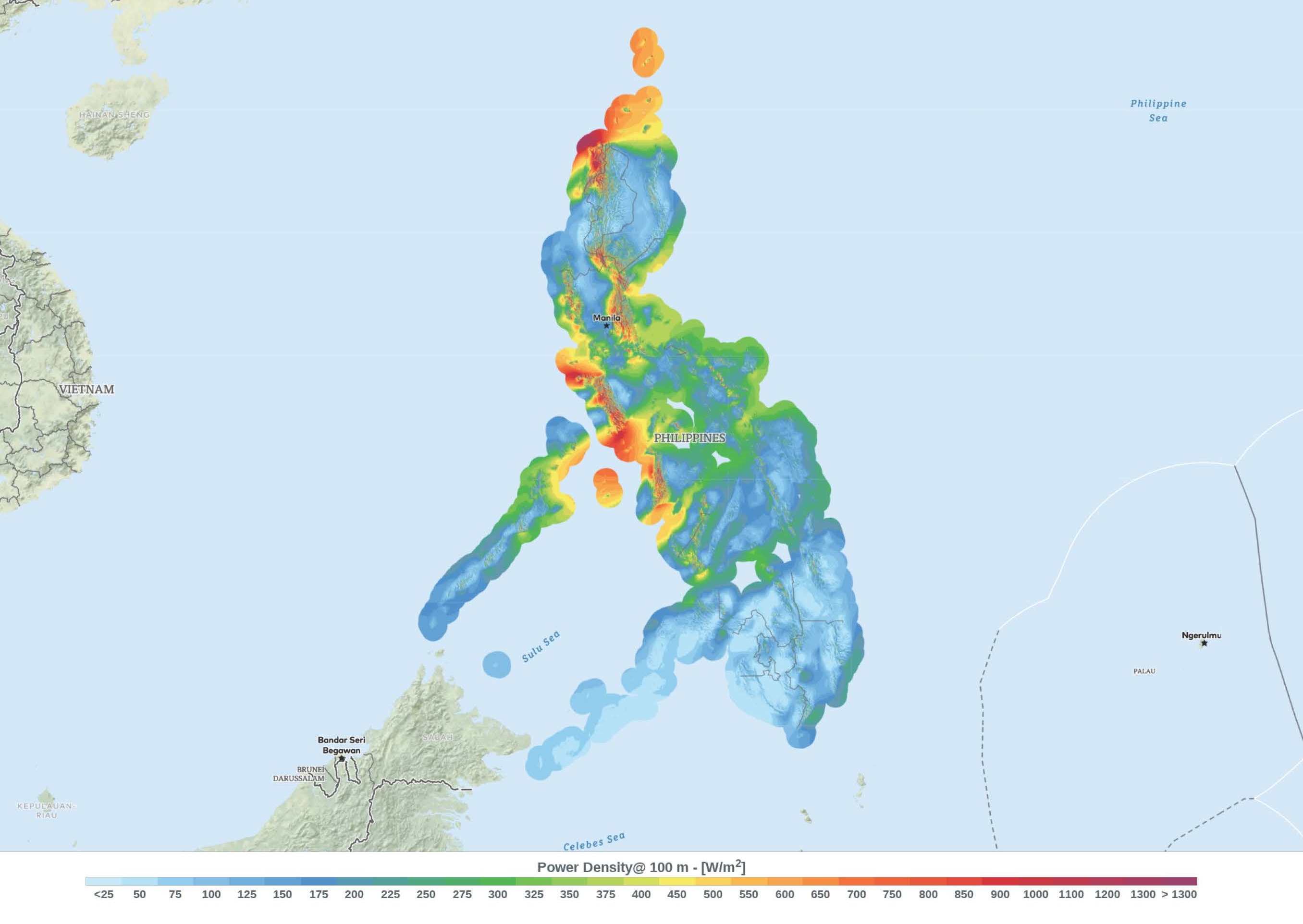
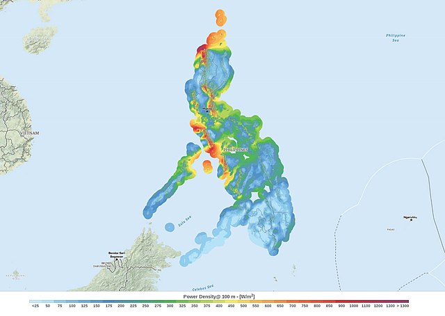
This wind resource map provides an estimated summary of mean wind power density at 100 m above surface level. Power density indicates wind power potential, part of which can be extracted by wind turbines. The map is derived from high-resolution wind speed distributions based on a chain of models, which downscales winds from global models (~70 km), to mesoscale (9 km) to microscale (150 m terrain). The resulting resolution is 250 m.
|
| Date | |
| Source | https://globalwindatlas.info/ |
| Author | Technical University of Denmark |
The map is downloaded form the Global Wind Atlas (version 2.2), a free, web-based application developed, owned and operated by the Technical University of Denmark (DTU) in partnership with the World Bank Group, utilizing data provided by Vortex, with funding provided by the Energy Sector Management Assistance Program (ESMAP). For additional information: https://globalwindatlas.info
Licensing
This file is licensed under the
Creative Commons
Attribution 4.0 International
license.
-
You are free:
- to share – to copy, distribute and transmit the work
- to remix – to adapt the work
-
Under the following conditions:
- attribution – You must give appropriate credit, provide a link to the license, and indicate if changes were made. You may do so in any reasonable manner, but not in any way that suggests the licensor endorses you or your use.