Peterborough_RD_1933.png
No higher resolution available.
| Description |
English:
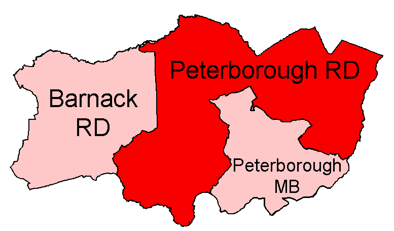
Peterborough Rural District, shown within the Soke of Peterborough.
All boundaries shown are correct for the period between 1933 and 1956, and with minor changes to 1974. Thorney RD was added to the Soke in 1965.
|
| Date | |
| Source |
Districts built up from parishes as cited at w:Civil parishes in Cambridgeshire . Modern parish boundaries from Ordnance Survey Boundary-Line datasets licensed under the Open Government Licence v1.0. Historic boundaries, where different, from copyright-expired Provisional/First Edition 1:25,000. |
| Author | Keith Edkins |
|
Permission
( Reusing this file ) |
This file is licensed under the
Creative Commons
Attribution-Share Alike 4.0 International
license.
|