Panorama_of_Anfield_with_new_main_stand_(29676137824).jpg

Size of this preview:
800 × 545 pixels
.
Other resolutions:
320 × 218 pixels
|
640 × 436 pixels
|
1,024 × 697 pixels
|
1,280 × 871 pixels
|
2,560 × 1,743 pixels
|
3,148 × 2,143 pixels
.
Summary
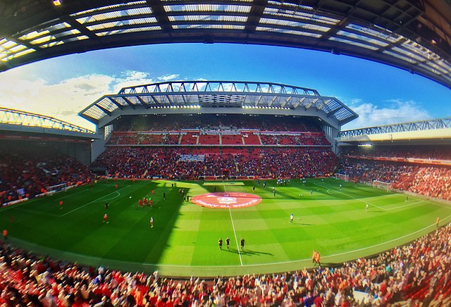
| Description | Panorama of Anfield stadium, taken from the Centenary Stand, showing from left to right: The Kop, the new Main Stand and the Anfield Road Stand |
| Date | |
| Source | The revamped Main Stand Anfield |
| Author | Ruaraidh Gillies |
| Camera location |
|
View this and other nearby images on: OpenStreetMap |
|
|---|
.jpg¶ms=053.430839_N_-002.960818_E_globe:Earth_type:camera_source:Flickr_&language=en)
Licensing
This file is licensed under the
Creative Commons
Attribution-Share Alike 2.0 Generic
license.
-
You are free:
- to share – to copy, distribute and transmit the work
- to remix – to adapt the work
-
Under the following conditions:
- attribution – You must give appropriate credit, provide a link to the license, and indicate if changes were made. You may do so in any reasonable manner, but not in any way that suggests the licensor endorses you or your use.
- share alike – If you remix, transform, or build upon the material, you must distribute your contributions under the same or compatible license as the original.
|
|
This image was originally posted to Flickr by RuaraidhG at https://flickr.com/photos/75354150@N06/29676137824 . It was reviewed on 11 March 2017 by FlickreviewR and was confirmed to be licensed under the terms of the cc-by-sa-2.0. |