Pacific_SST_anomaly_10-15-2015.gif

Size of this preview:
800 × 499 pixels
.
Other resolutions:
320 × 200 pixels
|
640 × 399 pixels
|
930 × 580 pixels
.
Summary
| Description |
English:
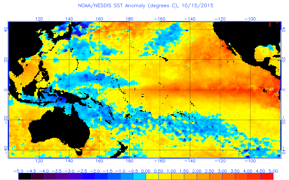
Map showing sea surface temperature anomalies in the Pacific Ocean on October 15, 2015.
|
| Date | |
| Source | https://www.ospo.noaa.gov/data/sst/anomaly/2015/anomp.10.15.2015.gif |
| Author | National Environmental Satellite, Data, and Information Service |
Licensing
|
|
This image is in the
public domain
because it contains materials that originally came from the U.S.
National Oceanic and Atmospheric Administration
, taken or made as part of an employee's official duties.
|
|