PIA16236-MarsCuriosityRover-EtThenRock-20121029.jpg

Summary
| Description |
English:
10.29.2012
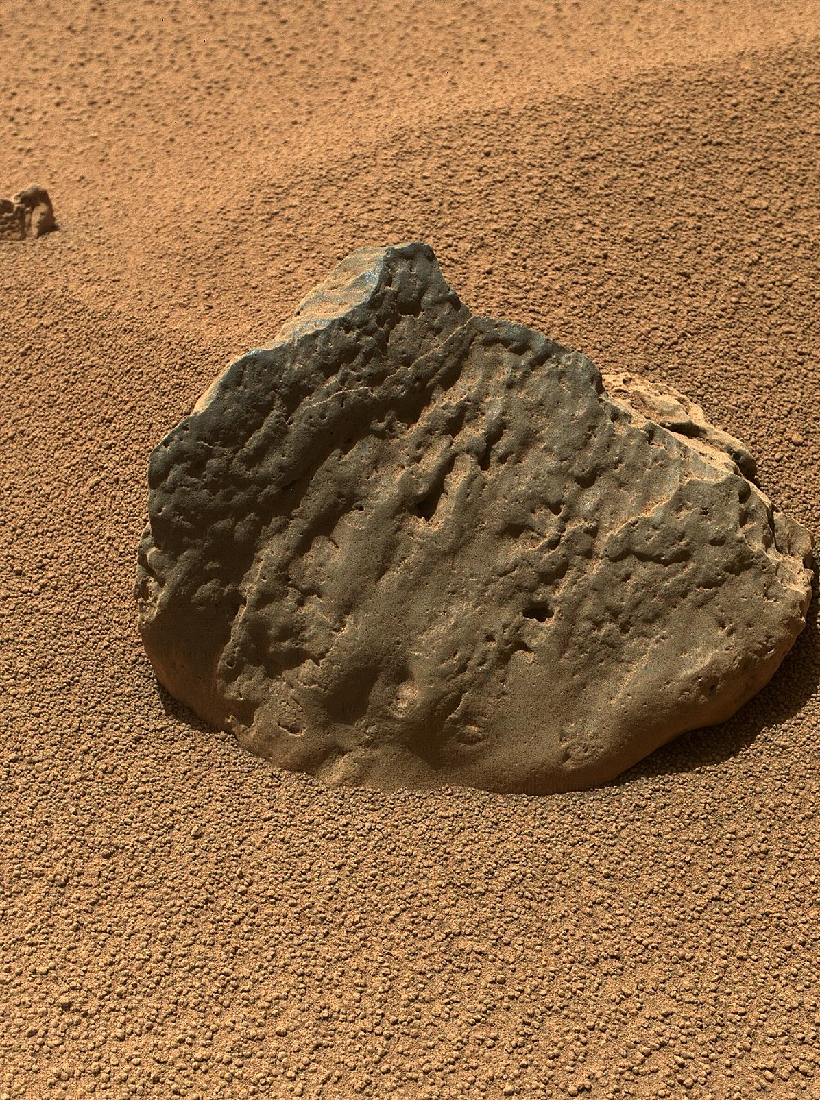
Rock 'Et-Then' Near Curiosity, Sol 82 http://photojournal.jpl.nasa.gov/catalog/PIA16236 The Mars Hand Lens Imager (MAHLI) on the arm of NASA's Mars rover Curiosity took this image of a rock called "Et-Then" during the mission's 82nd sol, or Martian day (Oct. 29, 2012.) The rock's informal name comes from the name of an island in Great Slave Lake, Northwest Territories, Canada. MAHLI viewed the rock from a distance of about 15.8 inches (40 centimeters). The image covers an area about 9.5 inches by 7 inches (24 centimeters by 18 centimeters). Et-Then is located near the rover's front left wheel, where the rover has been stationed while scooping soil at the site called "Rocknest." This is one of three images acquired by MAHLI from slightly different positions so that a three-dimensional information could be used to plan possible future examination of the rock. Image Credit: NASA/JPL-Caltech/MSSS |
| Date | |
| Source | http://photojournal.jpl.nasa.gov/jpeg/PIA16236.jpg |
| Author | NASA/JPL-Caltech/MSSS |
Licensing
|
|
This file is in the public domain in the United States because it was solely created by NASA . NASA copyright policy states that "NASA material is not protected by copyright unless noted ". (See Template:PD-USGov , NASA copyright policy page or JPL Image Use Policy .) |
|

|
Warnings:
|