PIA00170-MC-10-LunaePalusRegion-19980605.jpg

Size of this preview:
800 × 557 pixels
.
Other resolutions:
320 × 223 pixels
|
640 × 446 pixels
|
1,024 × 713 pixels
|
1,280 × 891 pixels
|
2,560 × 1,782 pixels
|
7,170 × 4,991 pixels
.
Summary
| Description |
English:
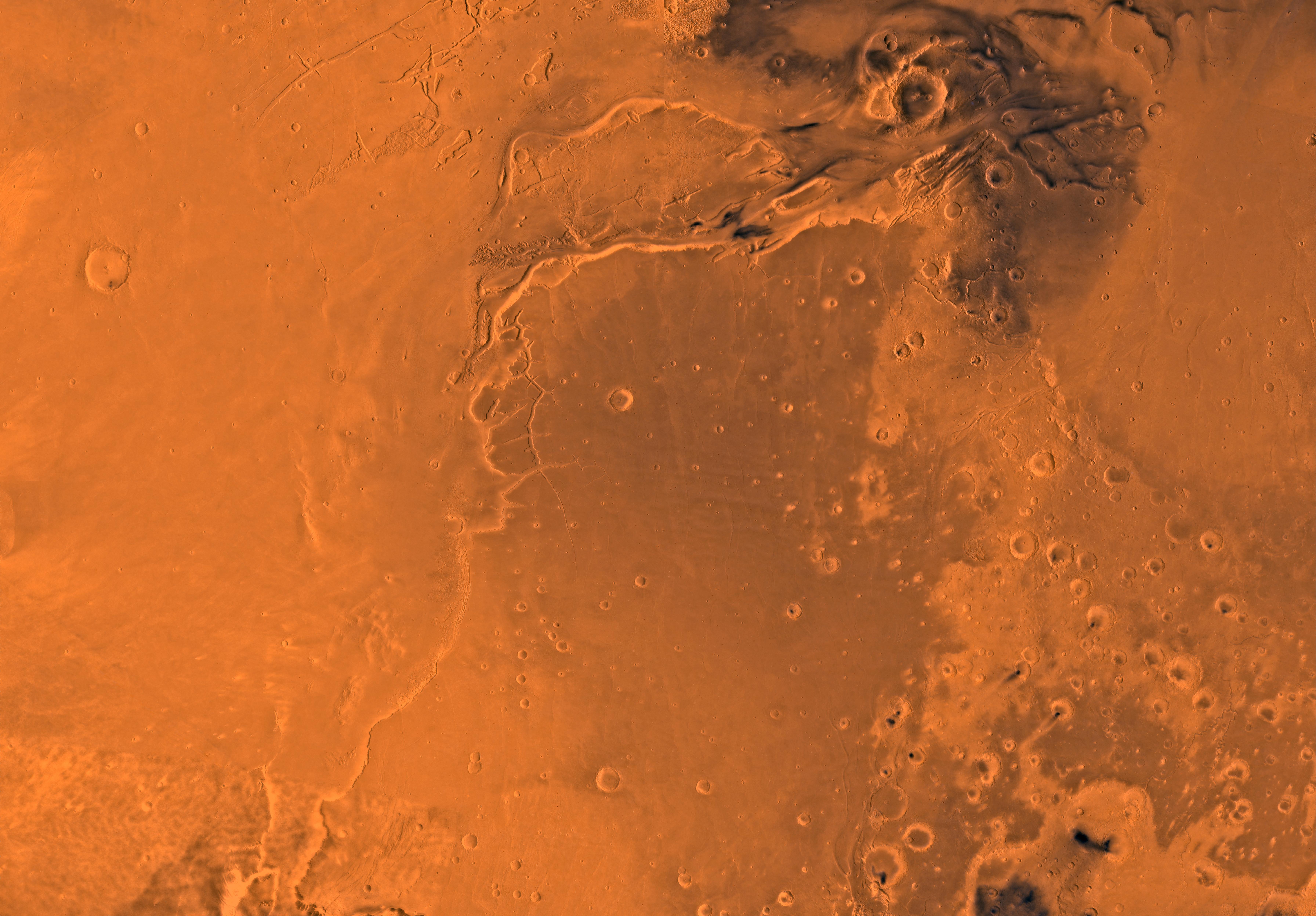
PIA00170: MC-10 Lunae Palus Region
Mars digital-image mosaic merged with color of the MC-10 quadrangle, Lanae Palus region of Mars. The western part is dominated by lava flows of the Tharsis region. The central part includes ridged terrain of Lunae Planum. The west and north borders of Lunae Planum are dissected by the large, relatively young outflow channel, Kasei Vallis, which terminates in Chryse Planitia. Latitude range 0 to 30 degrees, longitude range 45 to 90 degrees.
|
| Date | |
| Source | http://photojournal.jpl.nasa.gov/jpeg/PIA00170.jpg |
| Author | NASA/JPL/USGS |
| Other versions |
.jpg)
Licensing
|
|
This file is in the public domain in the United States because it was solely created by NASA . NASA copyright policy states that "NASA material is not protected by copyright unless noted ". (See Template:PD-USGov , NASA copyright policy page or JPL Image Use Policy .) |
|

|
Warnings:
|