Oxford_wards_OSM.svg

Size of this PNG preview of this SVG file:
583 × 600 pixels
.
Other resolutions:
233 × 240 pixels
|
466 × 480 pixels
|
746 × 768 pixels
|
995 × 1,024 pixels
|
1,990 × 2,048 pixels
|
657 × 676 pixels
.
| Description |
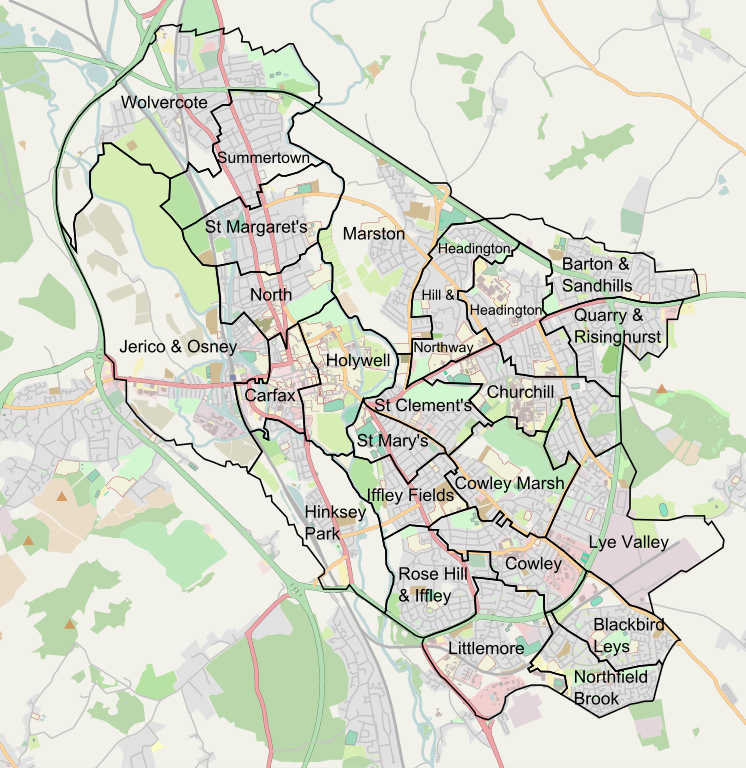
English:
Wards of Oxford (UK) for local elections. SVG version with OSM background.
This map of Oxford was created from
OpenStreetMap
project data, collected by the community.
This map may be incomplete, and may contain errors. Don't rely solely on it for navigation.
|
| Date | |
| Source | Boundaries: File:Oxford_wards.svg by me, which in turn is the SVG version of this image on en.wikipedia. Background: openstreetmap.org . See the background image in its original context on the OpenStreetMap wiki page for Oxford . |
| Author | Newprogressive , Mtcv , OpenStreetMap contributors |
|
Permission
( Reusing this file ) |
All OpenStreetMap data and maps are
Creative Commons
"CC-BY-SA 2.0" licensed
This file is licensed under the
Creative Commons
Attribution-Share Alike 2.0 Generic
license.
|
| Other versions | PNG version . SVG without OSM background |