Ostfriesland_Verkehr-de.svg

Size of this PNG preview of this SVG file:
740 × 568 pixels
.
Other resolutions:
313 × 240 pixels
|
626 × 480 pixels
|
1,001 × 768 pixels
|
1,280 × 982 pixels
|
2,560 × 1,965 pixels
.
| Description |
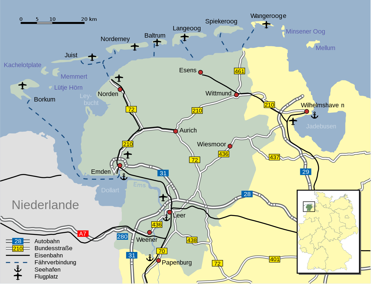
Deutsch:
Verkehr in
Ostfriesland
English:
Roads, railroads and ferries in
East Frisia
|
| Date | |
| Source | own work, using Ostfriesland de.svg by Enricopedia . |
| Author | NordNordWest |
| Other versions |
|


|
This SVG file contains embedded text that can be translated into your language, using any capable SVG editor, text editor or the SVG Translate tool . For more information see: About translating SVG files . |

|
This map has been made or improved in the German
Kartenwerkstatt
(Map Lab)
. You can
propose maps
to improve as well.
|
I, the copyright holder of this work, hereby publish it under the following license:
This file is licensed under the
Creative Commons
Attribution-Share Alike 2.5 Generic
license.
-
You are free:
- to share – to copy, distribute and transmit the work
- to remix – to adapt the work
-
Under the following conditions:
- attribution – You must give appropriate credit, provide a link to the license, and indicate if changes were made. You may do so in any reasonable manner, but not in any way that suggests the licensor endorses you or your use.
- share alike – If you remix, transform, or build upon the material, you must distribute your contributions under the same or compatible license as the original.