Osage_Creek_Bridge.jpg

Size of this preview:
765 × 600 pixels
.
Other resolutions:
306 × 240 pixels
|
612 × 480 pixels
|
980 × 768 pixels
|
1,280 × 1,004 pixels
|
2,560 × 2,007 pixels
|
4,764 × 3,735 pixels
.
|
|
This is an image of a place or building that is listed on the
National Register of Historic Places
in the
United States of America
. Its reference number is
87002418
.
|
| Camera location |
|
View this and other nearby images on: OpenStreetMap |
|
|---|
| Description |
English:
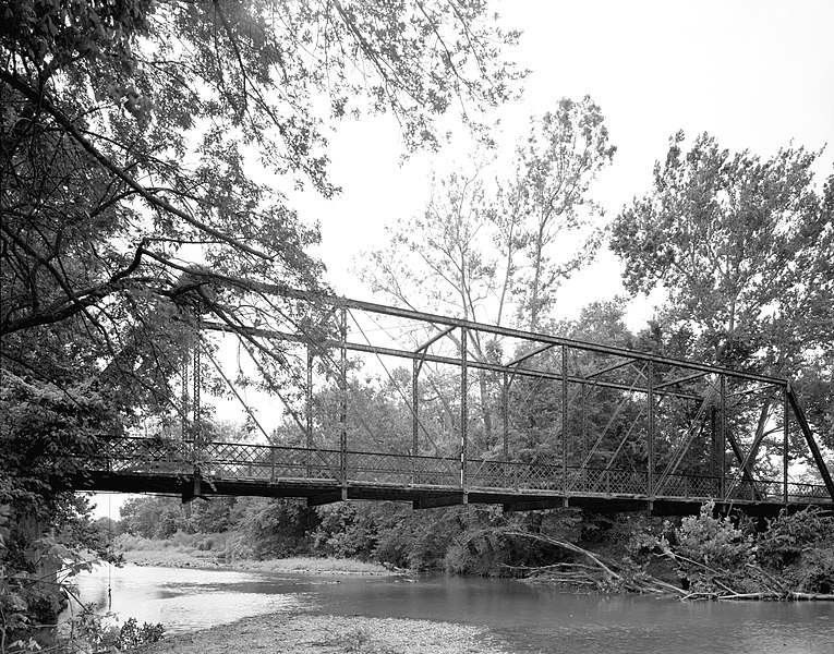
Eastern (upstream) side of the
Osage Creek Bridge
, which spans Osage Creek north of
Tontitown
in
Benton County
,
Arkansas
,
United States
. Built in 1911, this Pratt through truss bridge is listed on the
National Register of Historic Places
.
|
||||
| Date | |||||
| Source | Library of Congress , Prints and Photograph Division HAER : ARK,4-HESP.V,1-1 | ||||
| Author | Jeff Holder | ||||
|
Permission
( Reusing this file ) |
|

|
This image is available from the United States
Library of Congress
's
Prints and Photographs division
under the digital ID hhh.ar0088 . This tag does not indicate the copyright status of the attached work. A normal copyright tag is still required. See Commons:Licensing .
|