Opoki_outcrop.jpg
Size of this preview:
800 × 531 pixels
.
Other resolutions:
320 × 213 pixels
|
640 × 425 pixels
|
1,024 × 680 pixels
|
1,280 × 850 pixels
|
2,560 × 1,700 pixels
|
4,288 × 2,848 pixels
.
Summary
| Description |
English:
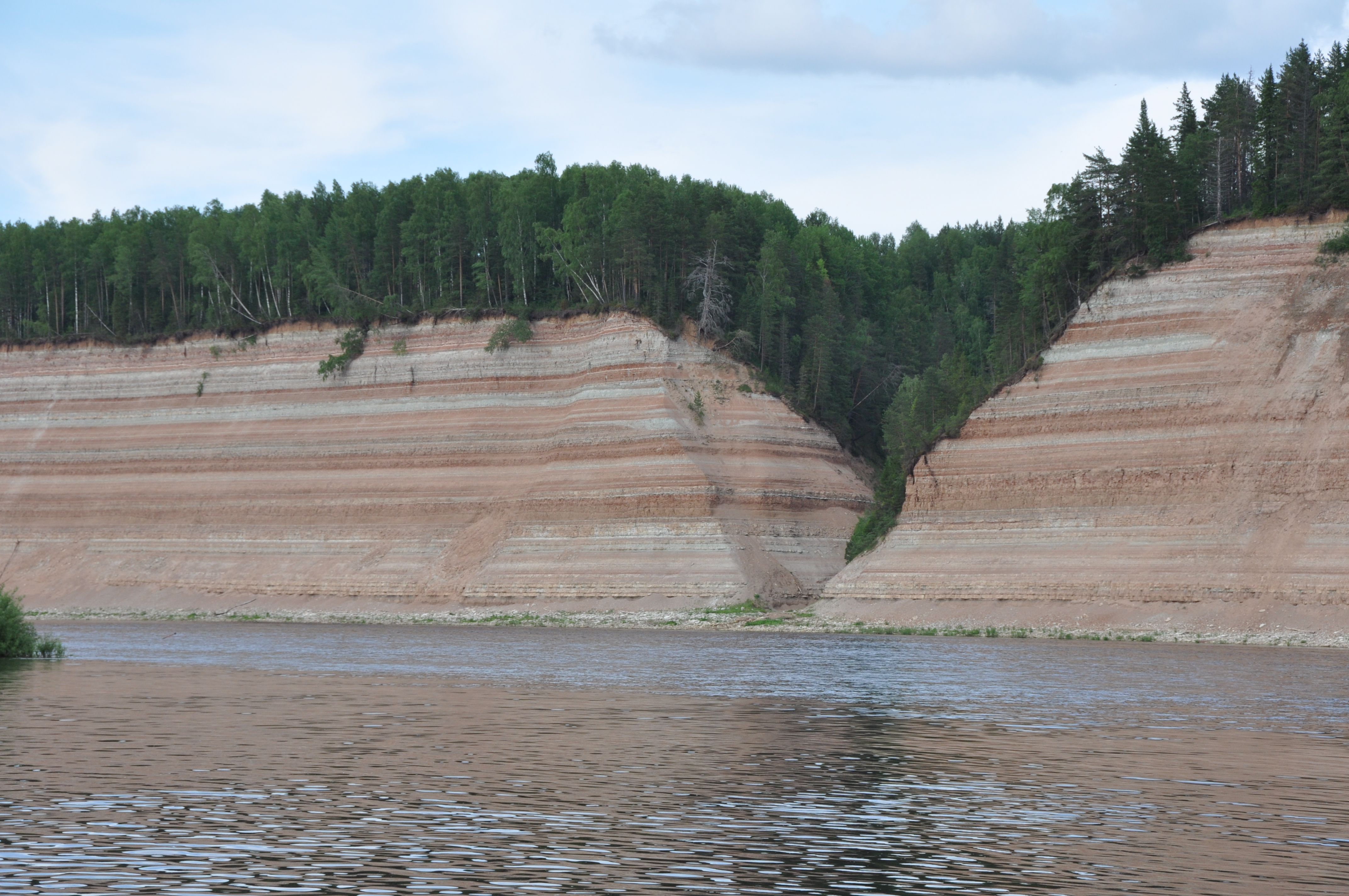
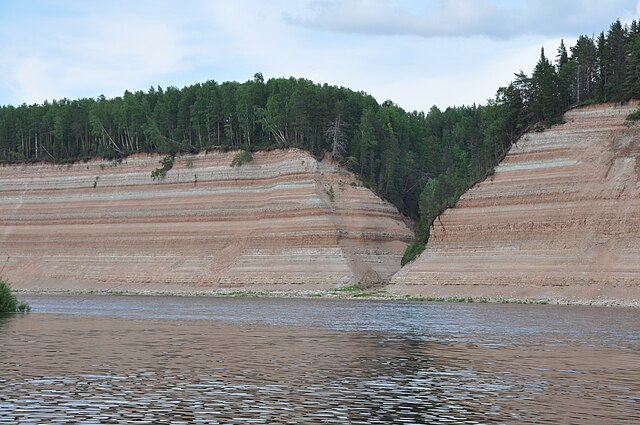
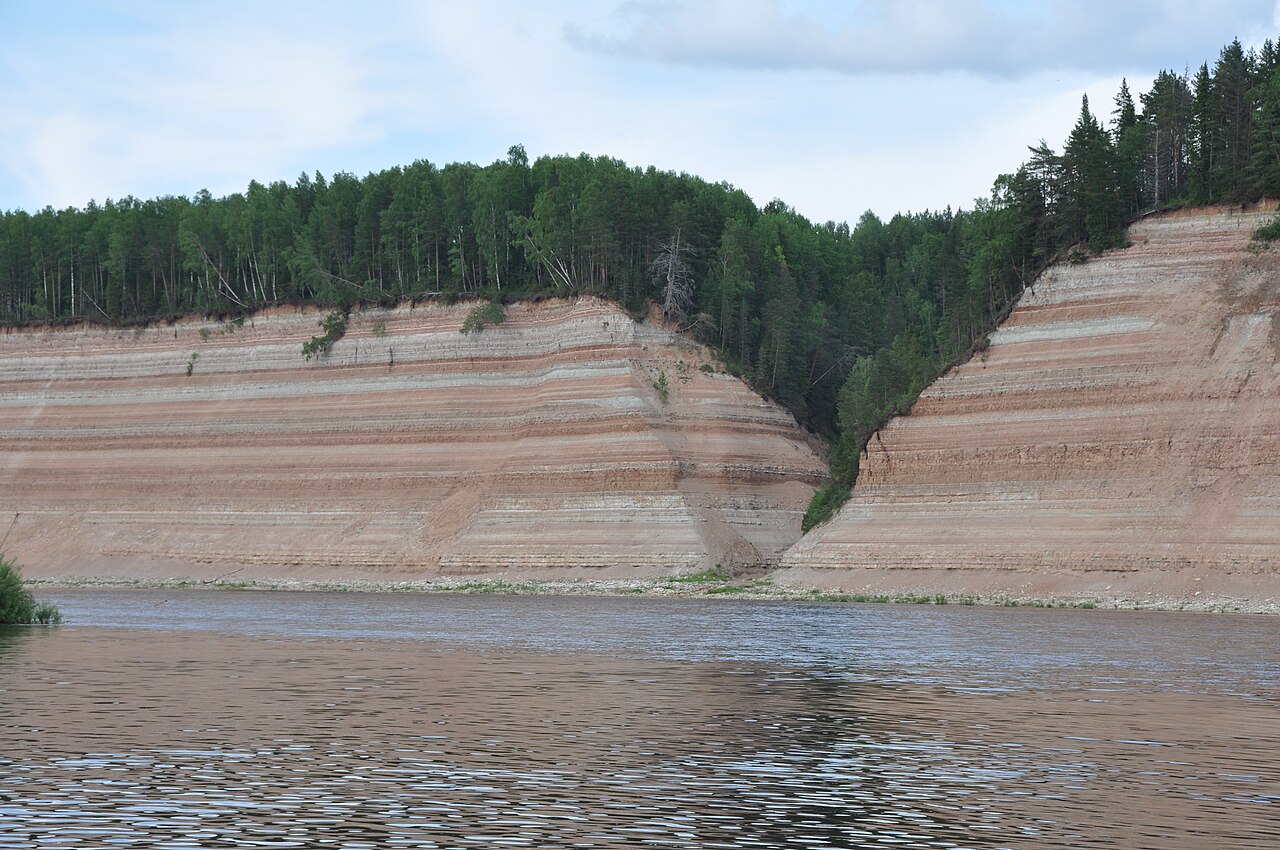
Cliff of alternating layers of
mudstone
and
marl
, at Opoki, near Poldarsa on the
Sukhona river
in the
Vologda oblast
of Russia. The cliff is about 60 metres high and the rocks are of late
Permian
age.
Русский:
Геологические обнажение в Опоках (Вологодская область)
|
| Date | |
| Source | Transferred from ru.wikipedia to Commons by Daryona using CommonsHelper . |
| Author | web-weg |
| Object location |
|
View this and other nearby images on: OpenStreetMap |
|
|---|
Licensing
Web-weg
at
Russian Wikipedia
, the copyright holder of this work, hereby publishes it under the following licenses:

|
Permission is granted to copy, distribute and/or modify this document under the terms of the GNU Free Documentation License , Version 1.2 or any later version published by the Free Software Foundation ; with no Invariant Sections, no Front-Cover Texts, and no Back-Cover Texts. A copy of the license is included in the section entitled GNU Free Documentation License . |
This file is licensed under the
Creative Commons
Attribution-Share Alike
3.0 Unported
,
2.5 Generic
,
2.0 Generic
and
1.0 Generic
license.
Attribution:
Web-weg
at
Russian Wikipedia
-
You are free:
- to share – to copy, distribute and transmit the work
- to remix – to adapt the work
-
Under the following conditions:
- attribution – You must give appropriate credit, provide a link to the license, and indicate if changes were made. You may do so in any reasonable manner, but not in any way that suggests the licensor endorses you or your use.
- share alike – If you remix, transform, or build upon the material, you must distribute your contributions under the same or compatible license as the original.
You may select the license of your choice.
Original upload log
The original description page was
here
. All following user names refer to ru.wikipedia.
- 2009-07-19 12:06 Web-weg 4288×2848× (5912027 bytes) {{Изображение | Описание = Геологические обнажение в Опоках (Вологодская область) | Источник = | Время создания = июнь 2009 | Автор = web