Operation_Ariel_1940_map.png
No higher resolution available.
Summary
| Description |
English:
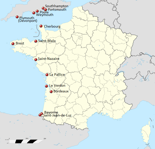
Ports utilised during the evacuation of British and Allied forces, 15–25 June 1940, under the codename Operation Ariel.
|
| Date | |
| Source | File:France location map-Regions and departements.svg |
| Author | Eric Gaba ( Sting - fr:Sting ) |
Licensing
This file is licensed under the
Creative Commons
Attribution-Share Alike 3.0 Unported
license.
-
You are free:
- to share – to copy, distribute and transmit the work
- to remix – to adapt the work
-
Under the following conditions:
- attribution – You must give appropriate credit, provide a link to the license, and indicate if changes were made. You may do so in any reasonable manner, but not in any way that suggests the licensor endorses you or your use.
- share alike – If you remix, transform, or build upon the material, you must distribute your contributions under the same or compatible license as the original.