October_24,_1861_county_vote_for_West_Virginia_statehood.jpg
Size of this preview:
774 × 599 pixels
.
Other resolutions:
310 × 240 pixels
|
620 × 480 pixels
|
992 × 768 pixels
|
1,280 × 991 pixels
|
2,560 × 1,982 pixels
|
6,587 × 5,100 pixels
.
Summary
| Description |
English:
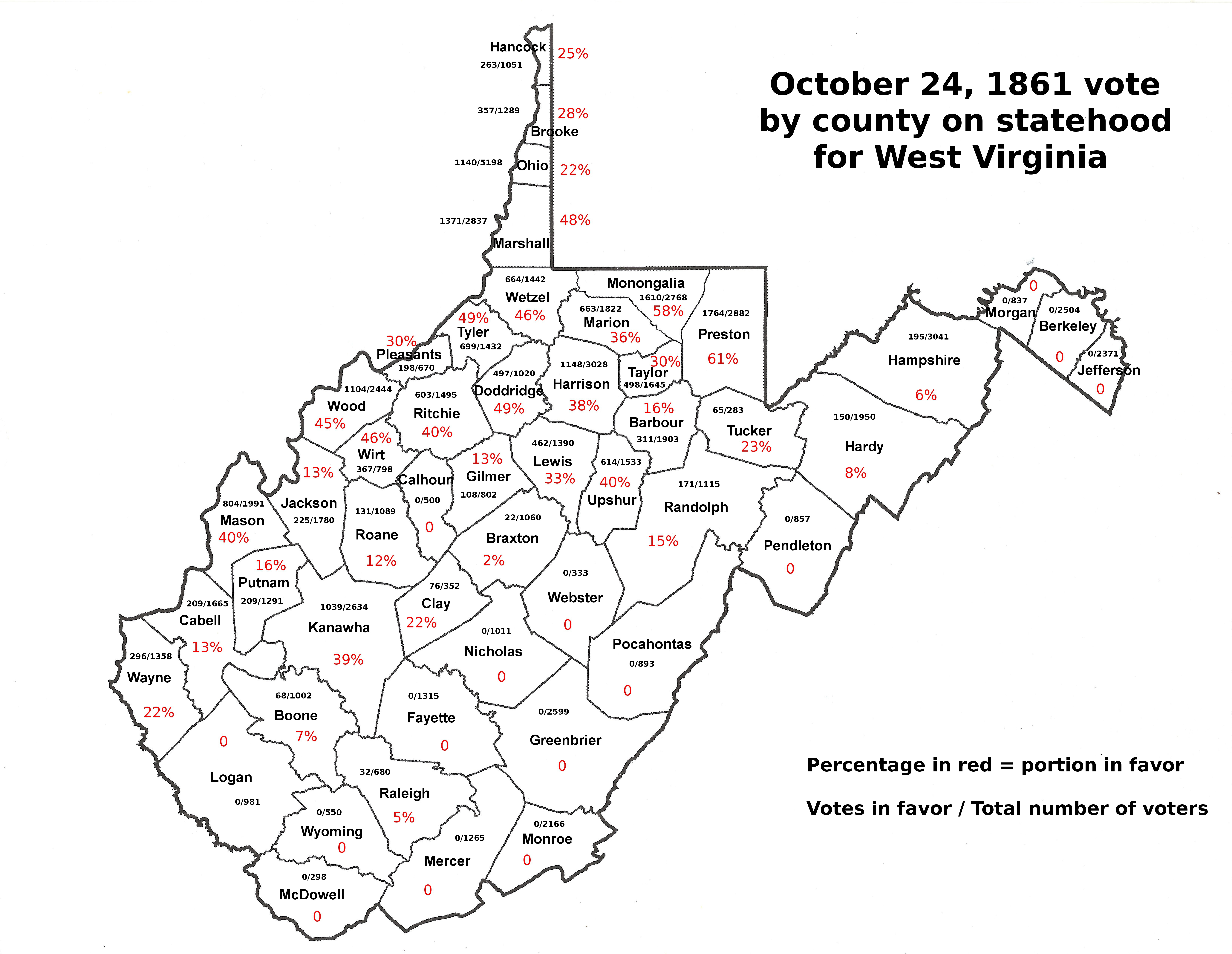
Map of the 50 western Virginia counties and the vote for a separate state cast of October 24, 1861. 1860 county census date for voter numbers for each county, 21 years old and older.
|
| Date | |
| Source | Own work |
| Author | Dubyavee |
Licensing
I, the copyright holder of this work, hereby publish it under the following license:
This file is licensed under the
Creative Commons
Attribution-Share Alike 4.0 International
license.
-
You are free:
- to share – to copy, distribute and transmit the work
- to remix – to adapt the work
-
Under the following conditions:
- attribution – You must give appropriate credit, provide a link to the license, and indicate if changes were made. You may do so in any reasonable manner, but not in any way that suggests the licensor endorses you or your use.
- share alike – If you remix, transform, or build upon the material, you must distribute your contributions under the same or compatible license as the original.