Occupation_of_vojvodina.png
Size of this preview:
561 × 599 pixels
.
Other resolutions:
225 × 240 pixels
|
449 × 480 pixels
|
719 × 768 pixels
|
959 × 1,024 pixels
|
1,548 × 1,653 pixels
.
Summary
| Description |
English:
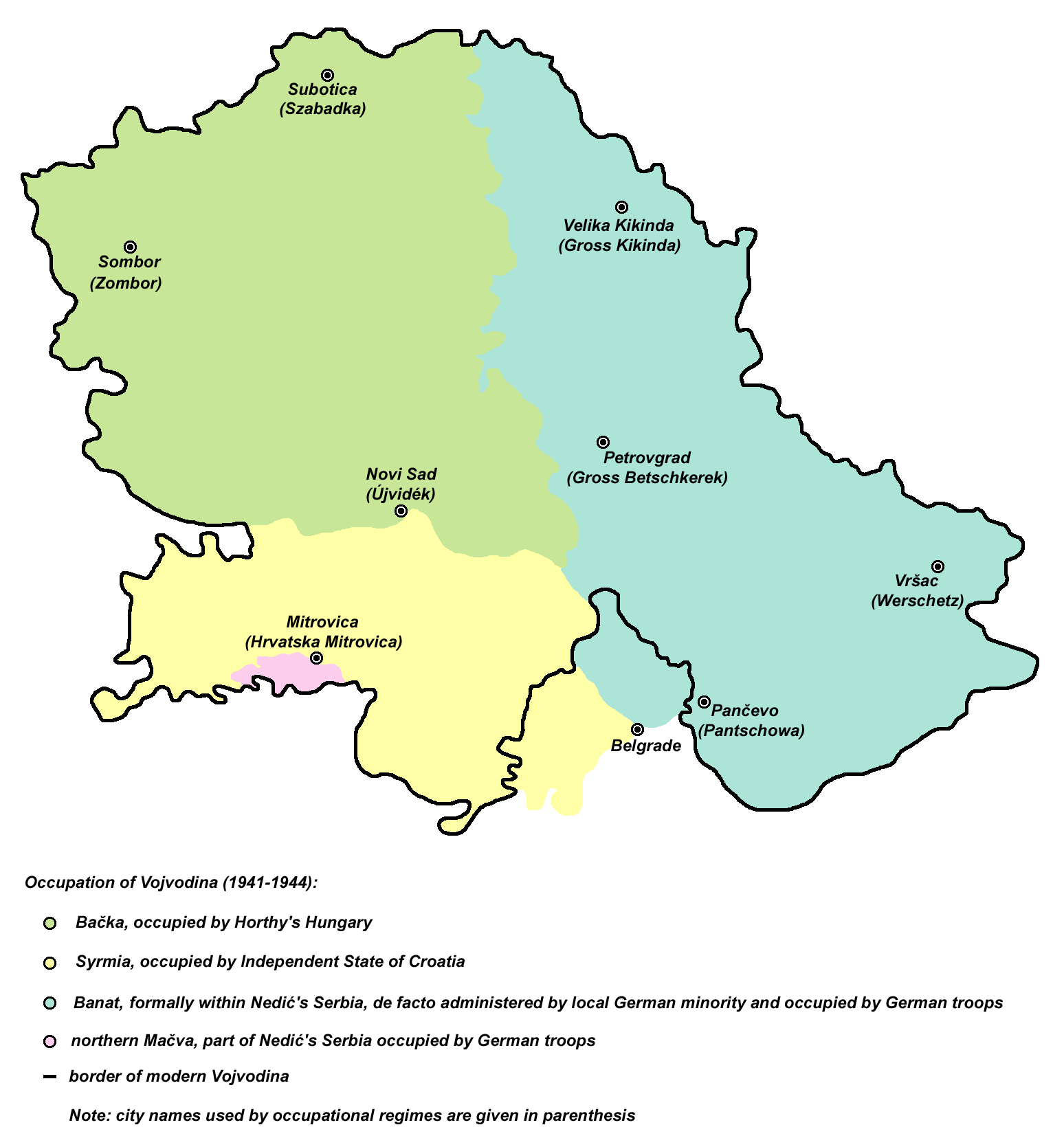
historic map of
en:Vojvodina
during Axis occupation (self made)
Serbian : историјска мапа Војводине за време окупације од стране Сила осовине |
| Date | 14 April 2007 (original upload date) |
| Source | Transferred from en.wikipedia to Commons by BokicaK using CommonsHelper . |
| Author | PANONIAN at English Wikipedia |
| Other versions | Derivative works of this file: Occupation of vojvodina-sr.png |
References
- Istorijski atlas, Zavod za udžbenike i nastavna sredstva - Zavod za kartografiju "Geokarta", Beograd, 1999.
- Školski istorijski atlas, Zavod za izdavanje udžbenika Socijalističke Republike Srbije, Beograd, 1970.
- Denis Šehić - Demir Šehić, Istorijski atlas Sveta, Beograd, 2007.
- The Times History of Europe, Times Books, 2002.
- The Times History of the 20th Century, Times Books, 2004.
- Dimitrije Boarov, Politička istorija Vojvodine, Novi Sad, 2001.
- Peter Rokai - Zoltan Đere - Tibor Pal - Aleksandar Kasaš, Istorija Mađara, Beograd, 2002.
- Dr Tomislav Bogavac, Nestajanje Srba, Niš, 1994.
- Tim Džuda, Srbi - Istorija, mit i razaranje Jugoslavije, Beograd, 2003.
- Jovan Pejin, Velikomađarski kapric, Zrenjanin, 2007.
- Jelena Popov, Vojvodina i Srbija, Veternik, 2001.
Licensing
|
|
This work has been released into the
public domain
by its author,
PANONIAN
at
English Wikipedia
. This applies worldwide.
In some countries this may not be legally possible; if so: PANONIAN grants anyone the right to use this work for any purpose , without any conditions, unless such conditions are required by law. |
Original upload log
The original description page was
here
. All following user names refer to en.wikipedia.
- 2007-04-14 18:34 PANONIAN 1548×1559× (100872 bytes) historic map of [[Vojvodina]] during Axis occupation (self made) {{PD-self}} [[Category:Maps of the history of Vojvodina]] [[Category:Maps of the history of Serbia]]