NowaMapaA18.svg

Size of this PNG preview of this SVG file:
643 × 599 pixels
.
Other resolutions:
258 × 240 pixels
|
515 × 480 pixels
|
824 × 768 pixels
|
1,099 × 1,024 pixels
|
2,198 × 2,048 pixels
|
776 × 723 pixels
.
Summary
| Description |
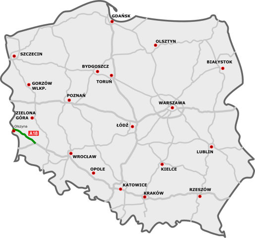
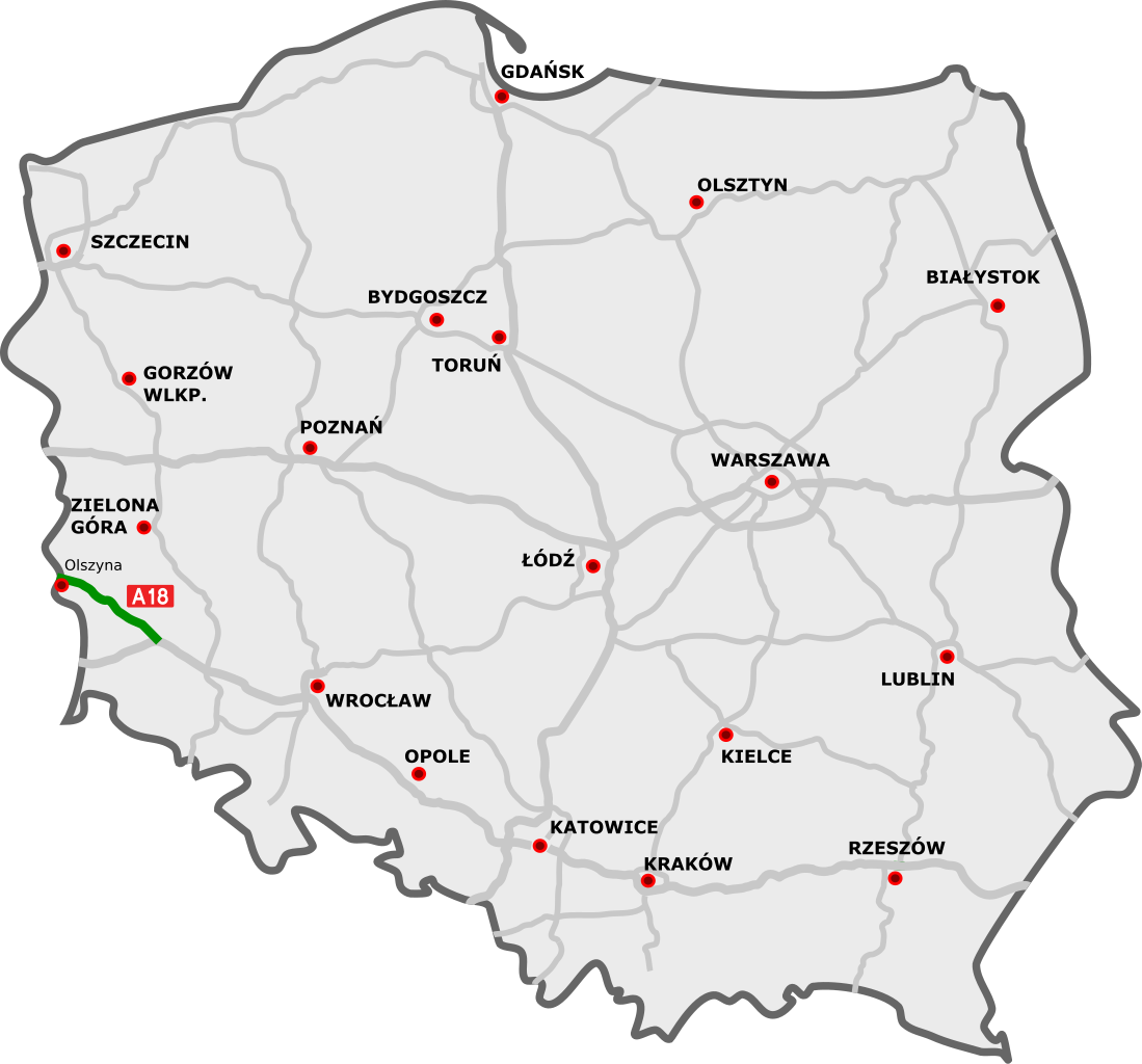
Polski:
Przebieg autostrady A18:
odcinki istniejące
odcinki w budowie
odcinki projektowane
English:
A18 motorway in Poland:
existing sections
sections under construction
planned sections
Deutsch:
Autobahn A18 in Polen:
Strecken unter Verkehr
Strecken in Bau
geplante Strecken
|
||
| Date | |||
| Source |
|
||
| Author |
|
||
| SVG development |
This file uses
embedded
text that can be
easily translated
using a text editor.
|
Licensing
I, the copyright holder of this work, hereby publish it under the following license:
This file is licensed under the
Creative Commons
Attribution 3.0 Unported
license.
-
You are free:
- to share – to copy, distribute and transmit the work
- to remix – to adapt the work
-
Under the following conditions:
- attribution – You must give appropriate credit, provide a link to the license, and indicate if changes were made. You may do so in any reasonable manner, but not in any way that suggests the licensor endorses you or your use.
Original upload log
This image is a derivative work of the following images:
-
DocelowyUkladDrog.svg
licensed with Cc-by-3.0, Cc-by-3.0
- 2009-08-30T16:41:32Z Sliwers 784x723 (155471 Bytes) Darker color.
- 2009-08-30T16:40:18Z Sliwers 784x723 (155471 Bytes) Cropped.
- 2009-08-30T16:36:58Z Sliwers 1073x790 (154212 Bytes) {{Information |Description={{en|1=Map of the planned free- and expressway network in Poland.}} {{pl|1=Docelowy układ autostrad i dróg ekspresowych w Polsce.}} {{de|1=Das Autobahn- und Schnellstraßennetz Polens, geplanter E
Uploaded with derivativeFX