North_Warwickshire_Line.png

Size of this preview:
424 × 600 pixels
.
Other resolutions:
169 × 240 pixels
|
339 × 480 pixels
|
543 × 768 pixels
|
1,169 × 1,654 pixels
.
Summary
| Description |
English:
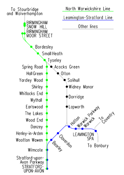
Diagrammatic map of the
North Warwickshire
and
Leamington to Stratford
lines; image created using
MicroStation
and exported as a png file.
|
| Date | |
| Source | Own work |
| Author | Voice of Clam |

|
This
transport map
image could be re-created
using
vector graphics
as an
SVG
file
. This has several advantages; see
Commons:Media for cleanup
for more information. If an SVG form of this image is available, please upload it and afterwards replace this template with
{{

vector version available

|

new image name

}}
.
It is recommended to name the SVG file “North Warwickshire Line.svg”—then the template Vector version available (or Vva ) does not need the new image name parameter. |
Licensing
|
|
This work has been released into the
public domain
by its author,
Voice of Clam
. This applies worldwide.
In some countries this may not be legally possible; if so:
|