Norbury_church_and_hall_046773_50c8b955.jpg
No higher resolution available.
|
This is a photo of
listed building
number
1281200
.
|
Summary
| Description |
English:
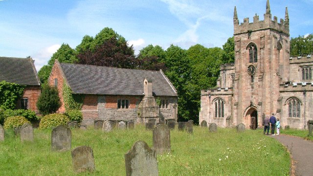
Part of SS Mary and Barlok parish churchyard,
Norbury, Derbyshire
. Left and centre is the Old Manor house, parts of which are 14th-century. On the right is the parish church.
|
| Date | |
| Source | From geograph.org.uk |
| Author | Alan Walker |
|
Permission
( Reusing this file ) |
Creative Commons Attribution Share-alike license 2.0 |
| Object location |
|
View this and other nearby images on: OpenStreetMap |
|
|---|
_region:GB-ENG_&language=en)
OSGB36: geotagged! SK 125 423 [100m precision]
WGS84: 52:58.6743N 1:48.9173W
Licensing

|
This image was taken from the
Geograph project
collection. See
this photograph's page
on the Geograph website for the photographer's contact details. The copyright on this image is owned by
Alan Walker
and is licensed for reuse under the
Creative Commons
Attribution-ShareAlike 2.0 license.
|
This file is licensed under the
Creative Commons
Attribution-Share Alike 2.0 Generic
license.
Attribution:
Alan Walker
-
You are free:
- to share – to copy, distribute and transmit the work
- to remix – to adapt the work
-
Under the following conditions:
- attribution – You must give appropriate credit, provide a link to the license, and indicate if changes were made. You may do so in any reasonable manner, but not in any way that suggests the licensor endorses you or your use.
- share alike – If you remix, transform, or build upon the material, you must distribute your contributions under the same or compatible license as the original.