Nilometer_Rhoda_Island_Cairo_June_1966.jpg

Size of this preview:
800 × 529 pixels
.
Other resolutions:
320 × 212 pixels
|
640 × 423 pixels
|
1,024 × 677 pixels
|
1,280 × 847 pixels
|
2,560 × 1,694 pixels
|
3,120 × 2,064 pixels
.
Summary
| Description |
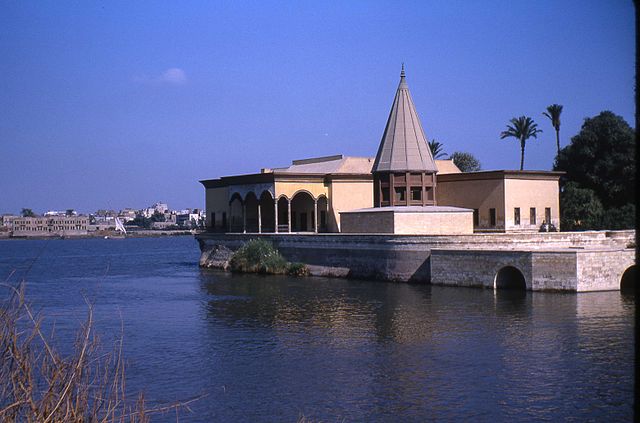
English:
Conical structure over the Nilometer on the southern tip of Rhoda (also Roda, Rodah, Rawda) Island in the Nile River at Cairo. The structure is modern but the Nilometer dates from 861 AD, and can be seen at
http://touregypt.net/featurestories/nilometerroda.htm
and
http://www.waterhistory.org/histories/cairo/
.
|
| Date | |
| Source | Own work |
| Author | Prong hunter |
Licensing
I, the copyright holder of this work, hereby publish it under the following licenses:
This file is licensed under the
Creative Commons
Attribution-Share Alike 3.0 Unported
license.
-
You are free:
- to share – to copy, distribute and transmit the work
- to remix – to adapt the work
-
Under the following conditions:
- attribution – You must give appropriate credit, provide a link to the license, and indicate if changes were made. You may do so in any reasonable manner, but not in any way that suggests the licensor endorses you or your use.
- share alike – If you remix, transform, or build upon the material, you must distribute your contributions under the same or compatible license as the original.

|
Permission is granted to copy, distribute and/or modify this document under the terms of the GNU Free Documentation License , Version 1.2 or any later version published by the Free Software Foundation ; with no Invariant Sections, no Front-Cover Texts, and no Back-Cover Texts. A copy of the license is included in the section entitled GNU Free Documentation License . |
You may select the license of your choice.