NewCaledonia2022OSM.png
Size of this preview:
736 × 600 pixels
.
Other resolutions:
295 × 240 pixels
|
589 × 480 pixels
|
942 × 768 pixels
|
1,257 × 1,024 pixels
|
2,513 × 2,048 pixels
|
6,816 × 5,555 pixels
.
Summary
| Description |
English:
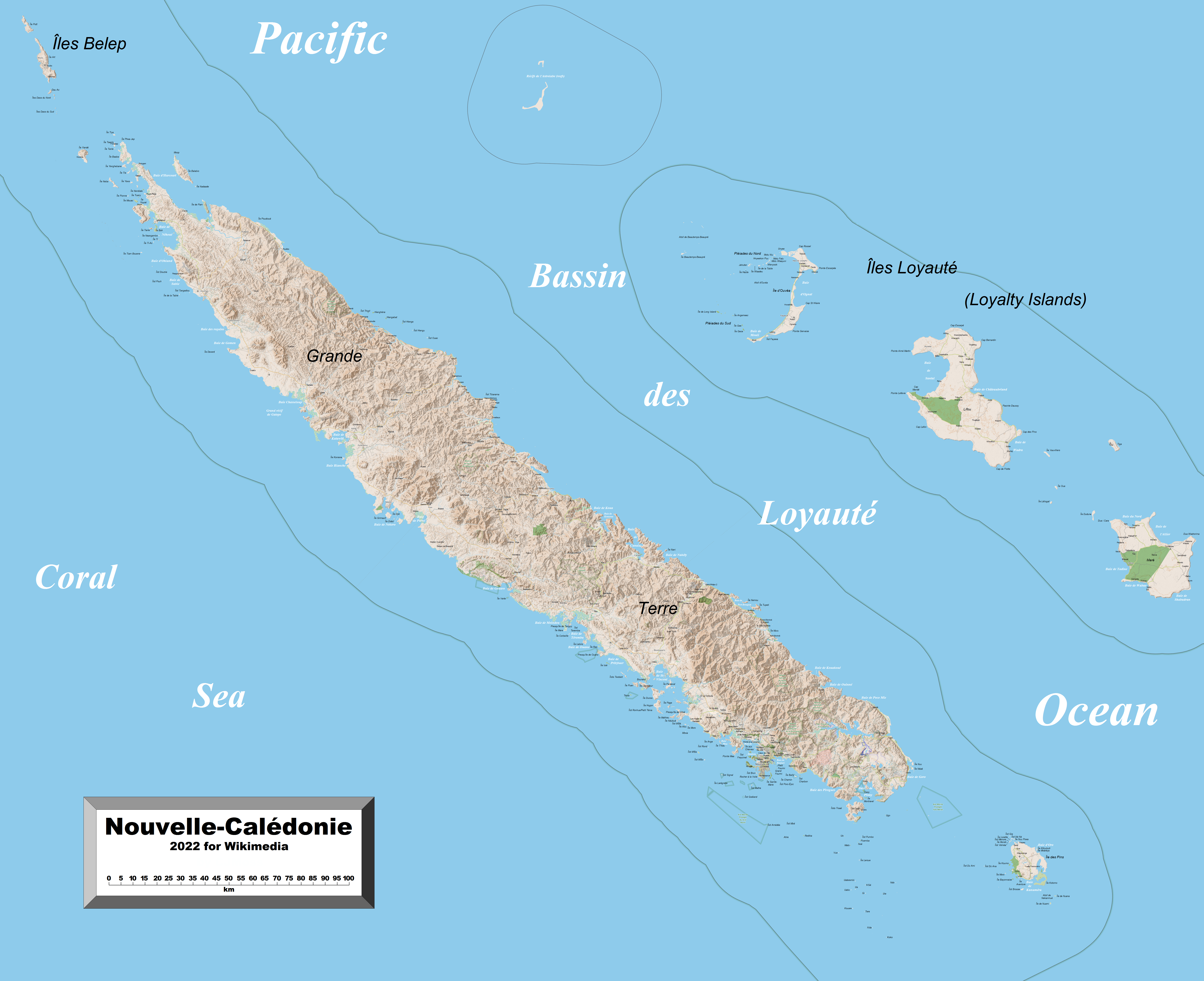
This map of New Caledonia (Grande Terre, the Loyalty Islands and other outlying islands) shows the islands' towns, villages and some other geographical details, and is likely the most comprehensive map of the islands in this respect that you'll find anywhere online. It has been stitched together from panels of Open Street Map (which is freely licensed to all) with details plotted by the uploader.
|
| Date | |
| Source | OpenStreetMap |
| Author | OpenStreetMap and contributors, Kelisi |
|
Permission
( Reusing this file ) |
The aforesaid website is freely usable to all. |
Licensing
I, the copyright holder of this work, hereby publish it under the following license:
This file is licensed under the
Creative Commons
Attribution-Share Alike 4.0 International
license.
-
You are free:
- to share – to copy, distribute and transmit the work
- to remix – to adapt the work
-
Under the following conditions:
- attribution – You must give appropriate credit, provide a link to the license, and indicate if changes were made. You may do so in any reasonable manner, but not in any way that suggests the licensor endorses you or your use.
- share alike – If you remix, transform, or build upon the material, you must distribute your contributions under the same or compatible license as the original.