Neckertal_20150527-6384.jpg
Size of this preview:
800 × 532 pixels
.
Other resolutions:
320 × 213 pixels
|
640 × 426 pixels
|
1,024 × 681 pixels
|
1,280 × 852 pixels
|
2,560 × 1,703 pixels
|
4,256 × 2,832 pixels
.
Summary
| Description |
English:
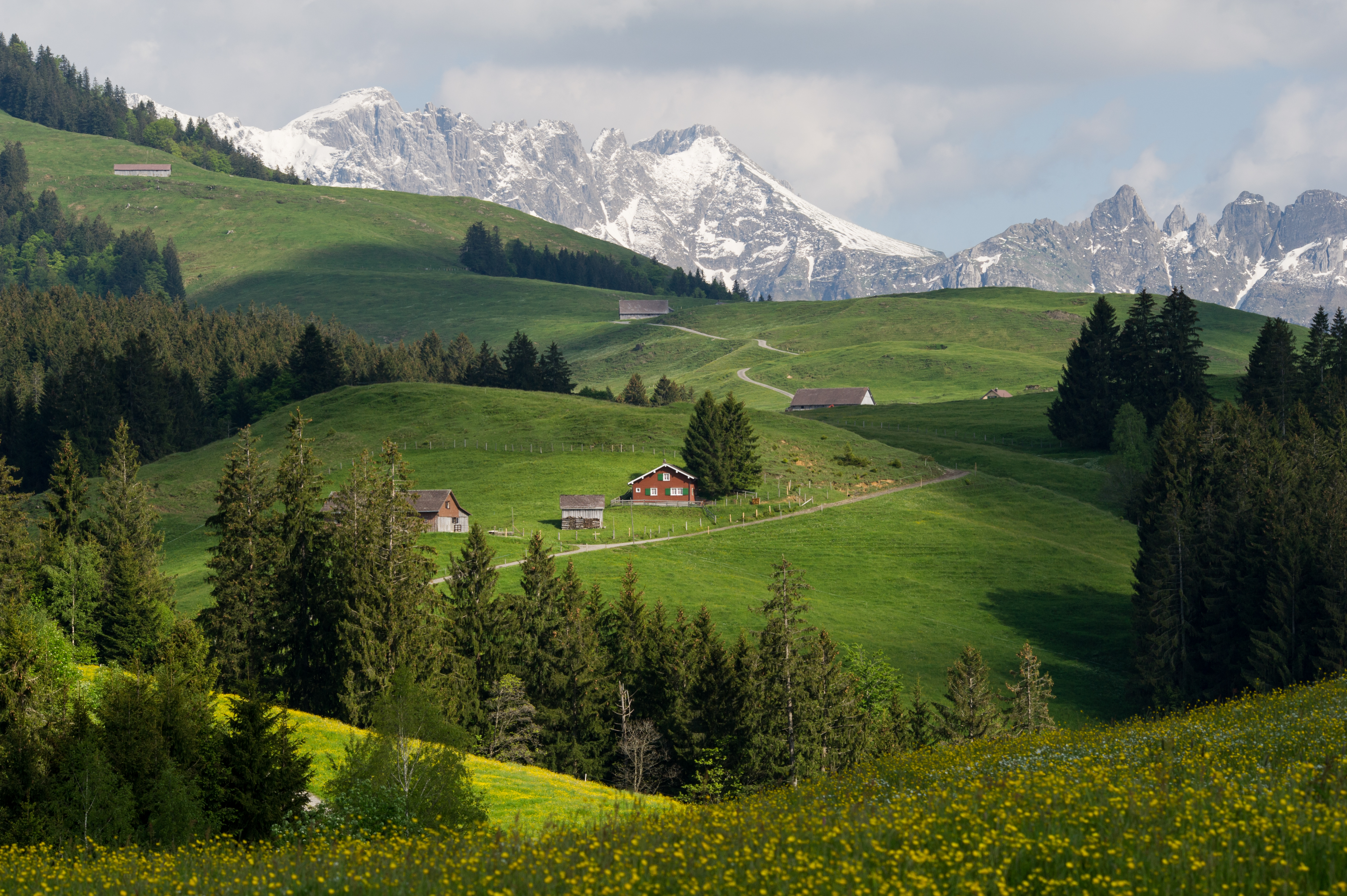
On the edge of the Naturpark Neckertal runs a hiking route from Bächli (854 m) to Hochalp (1529 m).
Deutsch:
Am Rande des Naturparks Neckertal führt eine Wanderroute vom Bächli (854 m) zur Hochalp (1529 m).
Français :
Sur le chemin du Hochalp (1529 m) depuis Bächli (854 m, commune de Hemberg) dans le Naturpark Neckertal en Suisse. Le chalet rouge (734'520 238'352), se trouve sur la commune d'Urnäsch dans le canton d'Appenzell Rhodes-Intérieures. Le photographe se trouve sur la commune de Hemberg dans le canton de Saint-Gall. Sommets faisant partie du massif de l'Alpstein: Silberplatten (2156 m), Stoss (2111 m) derrière le chalet rouge.
|
| Date | |
| Source | Own work |
| Author | Leiju |
Licensing
I, the copyright holder of this work, hereby publish it under the following license:
This file is licensed under the
Creative Commons
Attribution-Share Alike 3.0 Unported
license.
-
You are free:
- to share – to copy, distribute and transmit the work
- to remix – to adapt the work
-
Under the following conditions:
- attribution – You must give appropriate credit, provide a link to the license, and indicate if changes were made. You may do so in any reasonable manner, but not in any way that suggests the licensor endorses you or your use.
- share alike – If you remix, transform, or build upon the material, you must distribute your contributions under the same or compatible license as the original.
|
|
This image was uploaded as part of
Wiki Loves Earth 2015
.
|

|

|
This image won the 3
rd
prize in the national contest of
Switzerland
in
Wiki Loves Earth 2015
Other languages:
|
|
|
This image has been assessed using the
Quality image guidelines
and is considered a
Quality image
.
|