National-atlas-tennessee.PNG
Size of this preview:
785 × 599 pixels
.
Other resolutions:
314 × 240 pixels
|
629 × 480 pixels
|
1,006 × 768 pixels
|
1,280 × 977 pixels
|
2,000 × 1,527 pixels
.
Summary
| Description |
English:
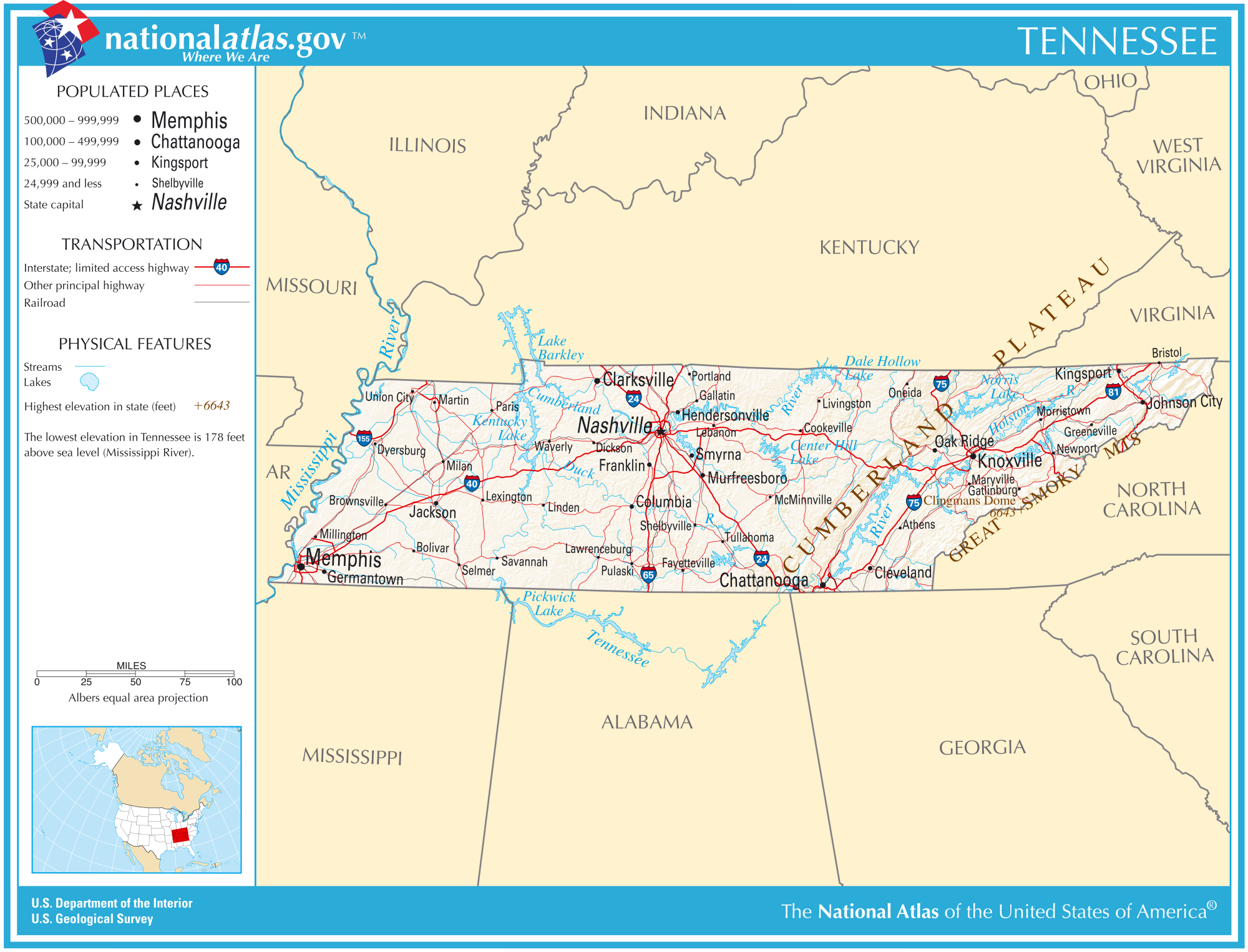
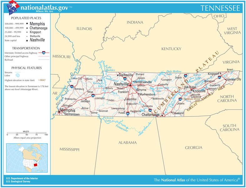
Reference map of Tennessee from the U.S. National Atlas.
|
| Date | |
| Source | http://nationalatlas.gov/printable/images/pdf/reference/pagegen_tn.pdf |
| Author | U.S. Department of the Interior |
Licensing
|
|
This map was obtained from an edition of the
National Atlas of the United States
. Like almost all works of the U.S. federal government, works from the
National Atlas
are in the
public domain
in the United States.
Online access: NationalAtlas.gov | 1970 print edition: Library of Congress , Perry-Castañeda Library
|
|
Original upload log
| date/time | username | resolution | size | edit summary |
|---|---|---|---|---|
| 22:14, 8 September 2005 | w:en:User:Evercat | 755×575 | 85 KB | Remove border |
| 00:41, 5 November 2004 | w:en:User:Queson | 801×621 | 82 KB | National atlas map of Tennessee |
Image description page history
| link | date/time | username | edit summary |
|---|---|---|---|
| http://en.wikipedia.org/w/index.php?title=Image:National-atlas-tennessee.PNG&redirect=no&oldid=16896337 | 07:11, 10 September 2007 | w:en:User:Dmcdevit | |
| http://en.wikipedia.org/w/index.php?title=Image:National-atlas-tennessee.PNG&redirect=no&oldid=16896337 | 22:38, 30 November 2004 | w:en:User:Jengod | |
| http://en.wikipedia.org/w/index.php?title=Image:National-atlas-tennessee.PNG&redirect=no&oldid=7996942 | 00:41, 5 November 2004 | w:en:User:Queson | (National atlas map of Tennessee) |