NPS_pinnacles-map.jpg

Size of this preview:
461 × 599 pixels
.
Other resolutions:
185 × 240 pixels
|
369 × 480 pixels
|
591 × 768 pixels
|
788 × 1,024 pixels
|
1,862 × 2,420 pixels
.
Summary
| Description |
English:
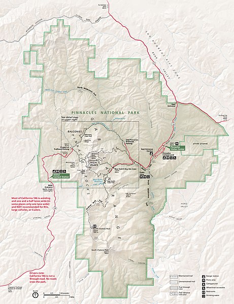
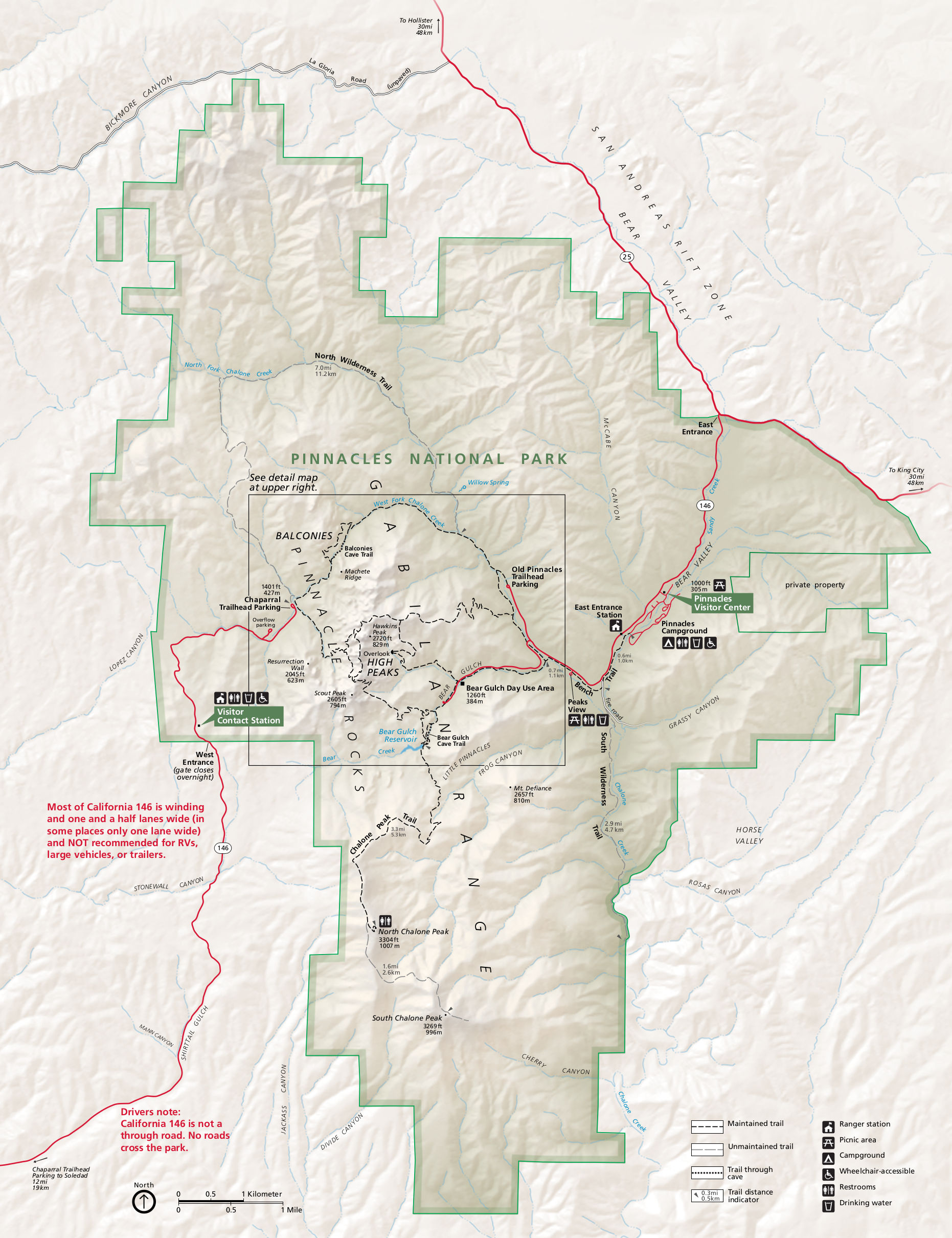
Main Pinnacles National Park map, showing roads, hiking trails, campgrounds, visitor centers, and points of interest.
|
| Date | |
| Source | U.S. National Park Service ( http://npmaps.com/wp-content/uploads/pinnacles-map.jpg ) |
| Author | U.S. National Park Service, restoration/cleanup by Matt Holly |
| Other versions |
|
Licensing
|
|
This image or media file contains material based on a work of a National Park Service employee, created as part of that person's official duties. As a work of the U.S. federal government , such work is in the public domain in the United States. See the NPS website and NPS copyright policy for more information. |
|