NPS_lake-mead-black-canyon-map.pdf

Size of this JPG preview of this PDF file:
364 × 600 pixels
.
Other resolutions:
146 × 240 pixels
|
291 × 480 pixels
|
466 × 768 pixels
|
1,275 × 2,100 pixels
.
Summary
| Description |
English:
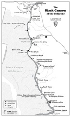
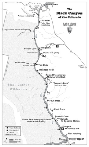
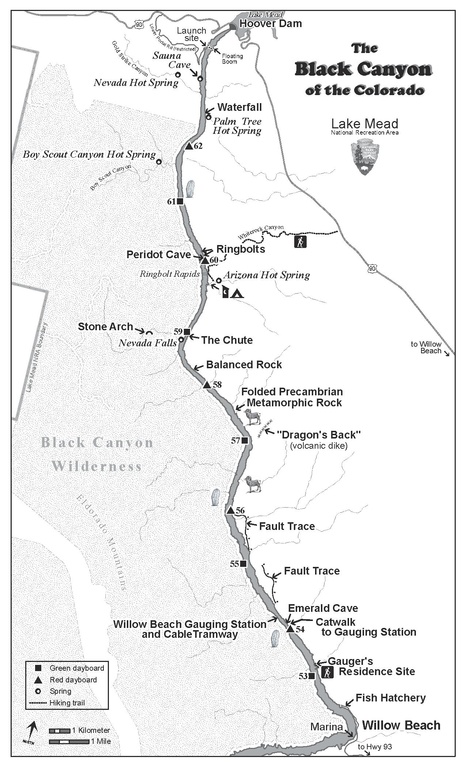
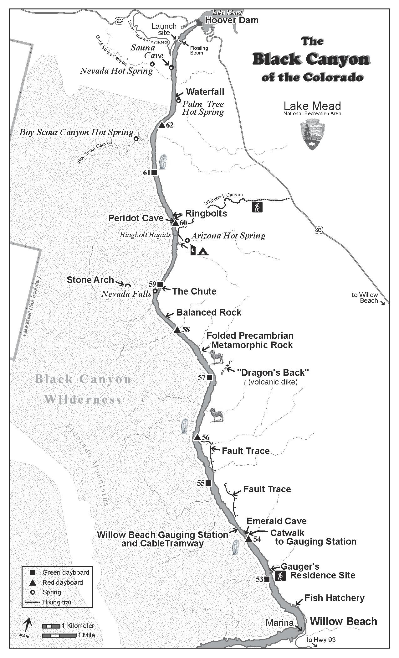
The Black Canyon map focuses on the Colorado River features between Lake Mead and Lake Mohave.
|
| Date | |
| Source | U.S. National Park Service ( http://npmaps.com/wp-content/uploads/lake-mead-black-canyon-map.pdf ) |
| Author | U.S. National Park Service, restoration/cleanup by Matt Holly |
| Other versions |

|
Licensing
|
|
This image or media file contains material based on a work of a National Park Service employee, created as part of that person's official duties. As a work of the U.S. federal government , such work is in the public domain in the United States. See the NPS website and NPS copyright policy for more information. |
|