NOAA_chart_25664_1976_detail.png
Size of this preview:
716 × 600 pixels
.
Other resolutions:
287 × 240 pixels
|
573 × 480 pixels
|
906 × 759 pixels
.
Summary
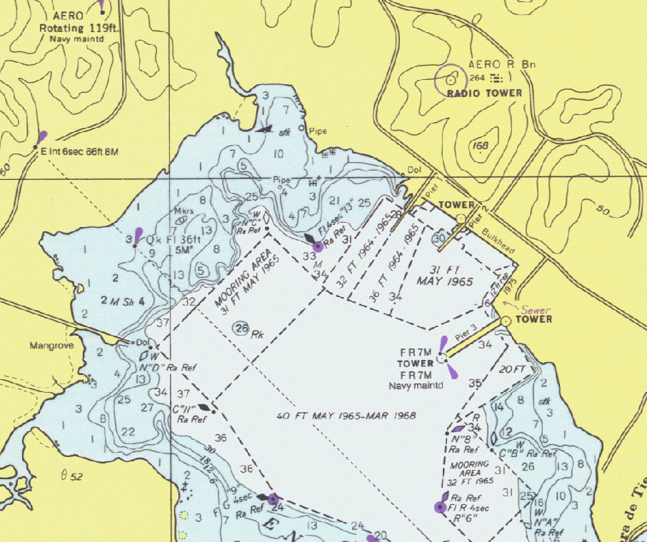
Detail of United States National Oceanic and Atmospheric Administration (NOAA) chart 25664 - Pasaje de Vieques and Radas Roosevelt, Puerto Rico.
This is from an outdated 1976 version of this chart; scanned by NOAA and provided through NOAA's Office of Coast Survey Historical Map and Chart Collection . Converted and clipped by the uploader.
Licensing
|
|
This image is in the
public domain
because it contains materials that originally came from the U.S.
National Oceanic and Atmospheric Administration
, taken or made as part of an employee's official duties.
|
|