NGA-Pacific_Loran.png

Size of this preview:
800 × 589 pixels
.
Other resolutions:
320 × 235 pixels
|
640 × 471 pixels
|
1,024 × 753 pixels
|
1,280 × 942 pixels
|
2,044 × 1,504 pixels
.
Summary
| Description |
English:
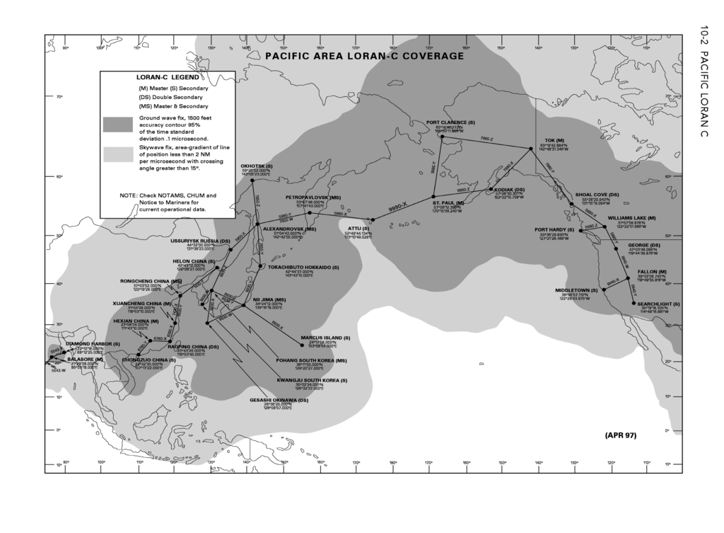
Coverage of Pacific Ocean LORAN-C chains as in 2006.
|
| Date | (first publication of chart April 1997) |
| Source | From DoD General Planning, 6 July 2006 , NGA ref PLANXGP , page 10-2. |
| Author | unlisted - collective work |
| Other versions |
This picture is part of a set: LORAN-C World coverage (2006)
|


Licensing
|
|
This image is a work of the United States
National Geospatial-Intelligence Agency
or one of
its predecessor agencies
. As a
work
of the
U.S. federal government
, the image is in the
public domain
.
|

|
|
|
This file was reviewed on 28 May 2009 by the
administrator
or
trusted user
Jappalang
(
talk
)
, who confirmed the
Public Domain
status on that date.
See talk page for why this image's PD status was endorsed by PD reviewers. |