NAMrad_Th_let.gif
Size of this preview:
796 × 600 pixels
.
Other resolutions:
319 × 240 pixels
|
637 × 480 pixels
|
1,020 × 768 pixels
|
1,236 × 931 pixels
.
Summary
| Description |
English:
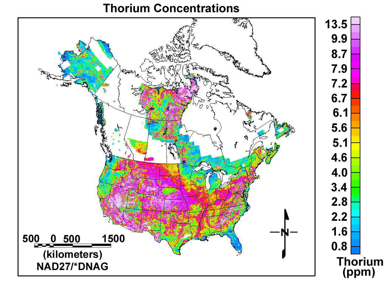
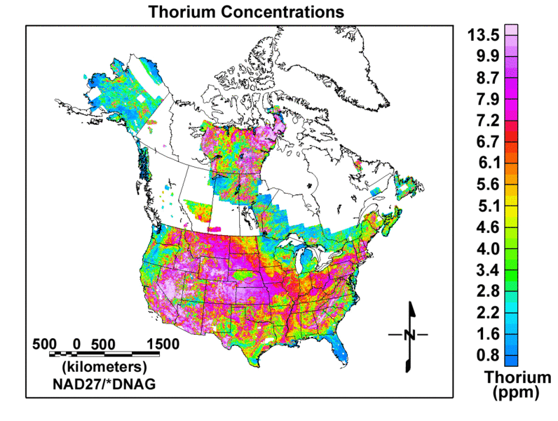
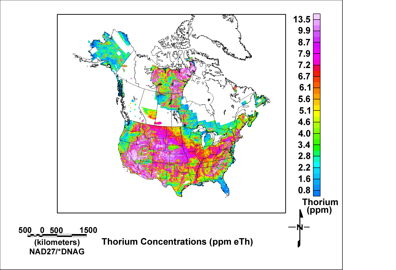
Map of Thorium Concentrations (most of USA and some of Canada) from USGS Open-File Report 2005-1413
|
| Date | |
| Source | http://pubs.usgs.gov/of/2005/1413/NAMrad_Th_let.gif via http://pubs.usgs.gov/of/2005/1413/maps.htm |
| Author | usgs.gov |
Licensing
|
|
This image is in the
public domain
in the United States because it only contains materials that originally came from the
United States Geological Survey
, an agency of the
United States Department of the Interior
. For more information, see
the official USGS copyright policy
.
|
|