Måbødalen,_2011_August.jpg

Size of this preview:
800 × 524 pixels
.
Other resolutions:
320 × 210 pixels
|
640 × 419 pixels
|
1,024 × 671 pixels
|
1,280 × 838 pixels
|
2,560 × 1,676 pixels
|
4,520 × 2,960 pixels
.
Summary
| Description |
Deutsch:
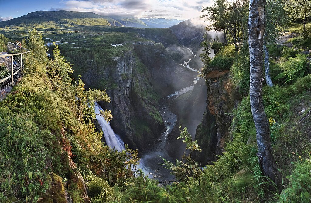
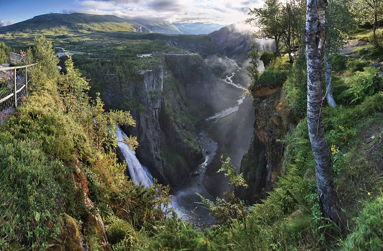
Ein weiter abendlicher Blick in das Måbødal in Eidfjord, Hordaland, Norwegen im August 2011. Die Ansicht wurde vom Ostende des Tales aufgenommen.
English:
A wide evening view to Måbødalen in
Eidfjord
municipality,
Hordaland
, Norway in 2011 August. The view has been captured from the eastern end of the valley.
Français :
Vue grand plan d'une matinée à Måbødalen,
Eidfjord
, dans le
Comté de Hordaland
, Norvège (août 2011). La vue est prise de l'entrée Est de la vallée.
Italiano:
Panorama del fiordo di Måbødalen nel territorio del comune di Eidfjord, contea di Sogn og Fjordane, Norvegia, agosto 2011.
This file was uploaded with
Commonist
.
|
| Date | |
| Source | Own work |
| Author | Ximonic , Simo Räsänen |
| Other versions |
|
.jpg)
| Camera location |
|
View this and other nearby images on: OpenStreetMap |
|
|---|
Assessment
|

|
|
This image was selected as
picture of the day
on Wikimedia Commons for
2 April 2013
. It was captioned as follows:
English:
A wide evening view to
Måbødalen
in
Eidfjord
municipality,
Hordaland
, Norway, in 2011 August.
Other languages:
Deutsch
:
Ein abendlicher Panoramablick in das Måbødal in Eidfjord, Sogn og Fjordane, Norwegen im August 2011.
English
:
A wide evening view to
Måbødalen
in
Eidfjord
municipality,
Hordaland
, Norway, in 2011 August.
Français
:
Vue grand plan d'une matinée à Måbødalen, kommune
Eidfjord
, dans le Comté de
Sogn og Fjordane
, Norvège en août 2011.
Italiano
:
Panorama del fiordo di Måbødalen nel territorio del comune di
Eidfjord
, contea di
Sogn og Fjordane
,
Norvegia
, agosto 2011.
Nederlands
:
Een wijde avondblik op de
Vøringsfossen
links en de
Måbødalen
in de gemeente
Eidfjord
in de provincie
Sogn og Fjordane
in Noorwegen.
Македонски
:
Поглед на клисурата Мобедален во општината
Ејдфјорд
, Норвешка.
日本語
:
ノルウェー、アイドフィヨルドにある谷、Måbødalenの夕刻の景色。
中文
:
挪威
埃德菲尤尔
莫伯达伦景色。
|
|
|
This image has been assessed using the
Quality image guidelines
and is considered a
Quality image
.
|
Licensing
Simo Räsänen, the copyright holder of this work, hereby publishes it under the following licenses:

|
Permission is granted to copy, distribute and/or modify this document under the terms of the GNU Free Documentation License , Version 1.2 or any later version published by the Free Software Foundation ; with no Invariant Sections, no Front-Cover Texts, and no Back-Cover Texts. A copy of the license is included in the section entitled GNU Free Documentation License . |
This file is licensed under the
Creative Commons
Attribution-Share Alike
3.0 Unported
,
2.5 Generic
,
2.0 Generic
and
1.0 Generic
license.
Attribution:
Simo Räsänen
-
You are free:
- to share – to copy, distribute and transmit the work
- to remix – to adapt the work
-
Under the following conditions:
- attribution – You must give appropriate credit, provide a link to the license, and indicate if changes were made. You may do so in any reasonable manner, but not in any way that suggests the licensor endorses you or your use.
- share alike – If you remix, transform, or build upon the material, you must distribute your contributions under the same or compatible license as the original.
You may select the license of your choice.
| Annotations | This image is annotated: View the annotations at Commons |