MoroccoWesternSaharaOMC.png
Size of this preview:
531 × 599 pixels
.
Other resolutions:
213 × 240 pixels
|
425 × 480 pixels
|
929 × 1,048 pixels
.
| Description |
English:
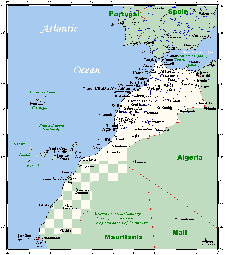
A map showing Morocco's and Western Sahara's cities and main towns.
|
||||||||
| Date | 14 August 2007 (original upload date) | ||||||||
| Source |
English:
This map's source is
here
, with the uploader's modifications, and the
GMT homepage
says that the tools are released under the GNU General Public License.
|
||||||||
| Author | The original uploader was Kelisi at English Wikipedia . | ||||||||
|
Permission
( Reusing this file ) |
planiglobe.com
, the copyright holder of this work, hereby publishes it under the following license:
|

Original upload log
The original description page was
here
. All following user names refer to en.wikipedia.
- 2007-08-14 01:24 Kelisi 929×1048× (46551 bytes) A map showing Morocco's and Western Sahara's cities and main towns. This map's source is [http://www.aquarius.ifm-geomar.de/ here], with the uploader's modifications, and the [http://gmt.soest.hawaii.edu/ GMT homepage] says that the tools ar